
H46A Fife Lake, MI, USA - Earthquake Result Viewer
| ||||||||||||||||||
| ||||||||||||||||||
| ||||||||||||||||||
|
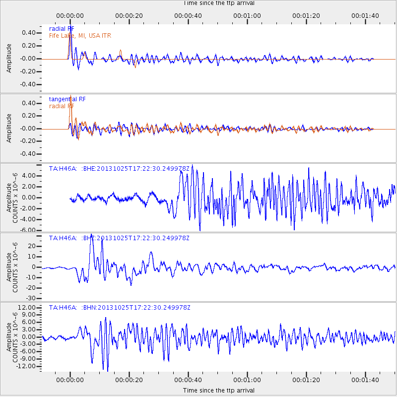
Signal To Noise
| Channel | StoN | STA | LTA |
| TA:H46A: :BHZ:20131025T17:22:30.249978Z | 8.296463 | 5.6612985E-6 | 6.8237495E-7 |
| TA:H46A: :BHN:20131025T17:22:30.249978Z | 2.7482247 | 1.6833792E-6 | 6.125333E-7 |
| TA:H46A: :BHE:20131025T17:22:30.249978Z | 2.6700304 | 1.112991E-6 | 4.1684584E-7 |
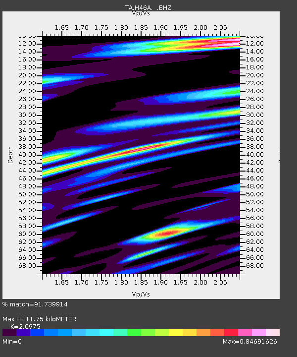
| Arrivals | |
| Ps | 2.0 SECOND |
| PpPs | 5.5 SECOND |
| PsPs/PpSs | 7.5 SECOND |

