
H47A Mio, MI, USA - Earthquake Result Viewer
| ||||||||||||||||||
| ||||||||||||||||||
| ||||||||||||||||||
|
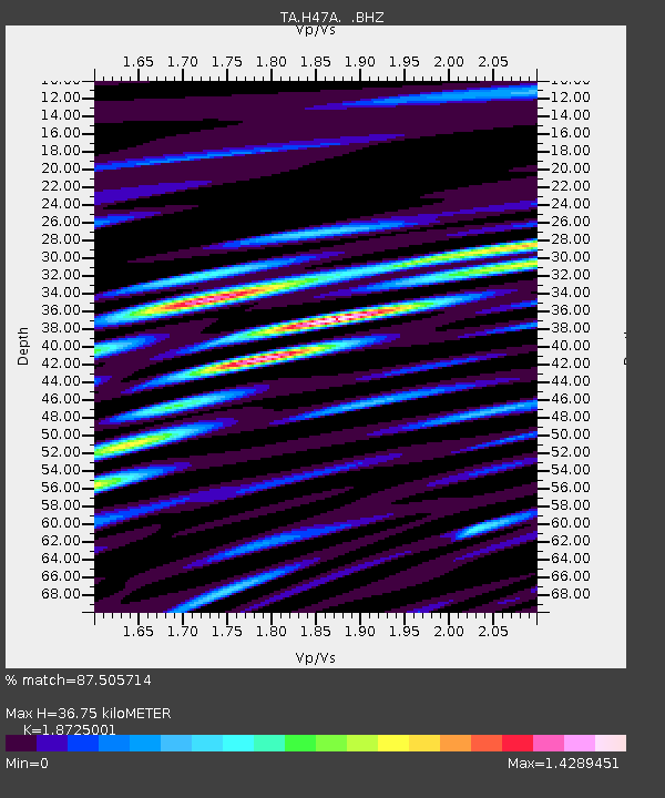
Signal To Noise
| Channel | StoN | STA | LTA |
| TA:H47A: :BHZ:20131025T17:22:32.098977Z | 16.790356 | 5.2947785E-6 | 3.1534643E-7 |
| TA:H47A: :BHN:20131025T17:22:32.098977Z | 2.5405753 | 1.5646388E-6 | 6.1586E-7 |
| TA:H47A: :BHE:20131025T17:22:32.098977Z | 2.8944237 | 1.535554E-6 | 5.305215E-7 |
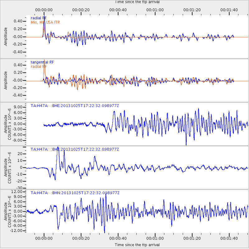
| Arrivals | |
| Ps | 5.1 SECOND |
| PpPs | 16 SECOND |
| PsPs/PpSs | 21 SECOND |

