H52A Wyevale, ON, CAN - Earthquake Result Viewer
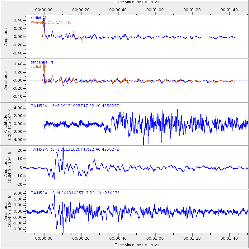
Earthquake location: Off East Coast Of Honshu, Japan
Earthquake latitude/longitude: 37.2/144.7
Earthquake time(UTC): 2013/10/25 (298) 17:10:19 GMT
Earthquake Depth: 35 km
Earthquake Magnitude: 7.1 MWW, 7.1 MWW, 7.1 MWB, 7.1 MWC, 7.2 MWC, 7.5 MI
Earthquake Catalog/Contributor: NEIC PDE/NEIC COMCAT
Network: TA USArray Transportable Network (new EarthScope stations)
Station: H52A Wyevale, ON, CAN
Lat/Lon: 44.64 N/79.89 W
Elevation: 209 m
Distance: 89.2 deg
Az: 30.056 deg
Baz: 325.907 deg
Ray Param: 0.042010088
Estimated Moho Depth: 31.5 km
Estimated Crust Vp/Vs: 1.94
Assumed Crust Vp: 6.577 km/s
Estimated Crust Vs: 3.39 km/s
Estimated Crust Poisson's Ratio: 0.32
Radial Match: 94.537834 %
Radial Bump: 357
Transverse Match: 86.08747 %
Transverse Bump: 400
SOD ConfigId: 626651
Insert Time: 2014-04-19 06:07:26.976 +0000
GWidth: 2.5
Max Bumps: 400
Tol: 0.001

Signal To Noise

ChannelStoNSTALTA
TA:H52A: :BHZ:20131025T17:22:40.425027Z9.1787994.7060516E-65.127089E-7
TA:H52A: :BHN:20131025T17:22:40.425027Z3.61170841.7249602E-64.776023E-7
TA:H52A: :BHE:20131025T17:22:40.425027Z1.85445437.288404E-73.930215E-7
Arrivals
Ps4.6 SECOND
PpPs14 SECOND
PsPs/PpSs18 SECOND