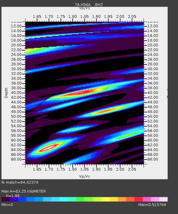
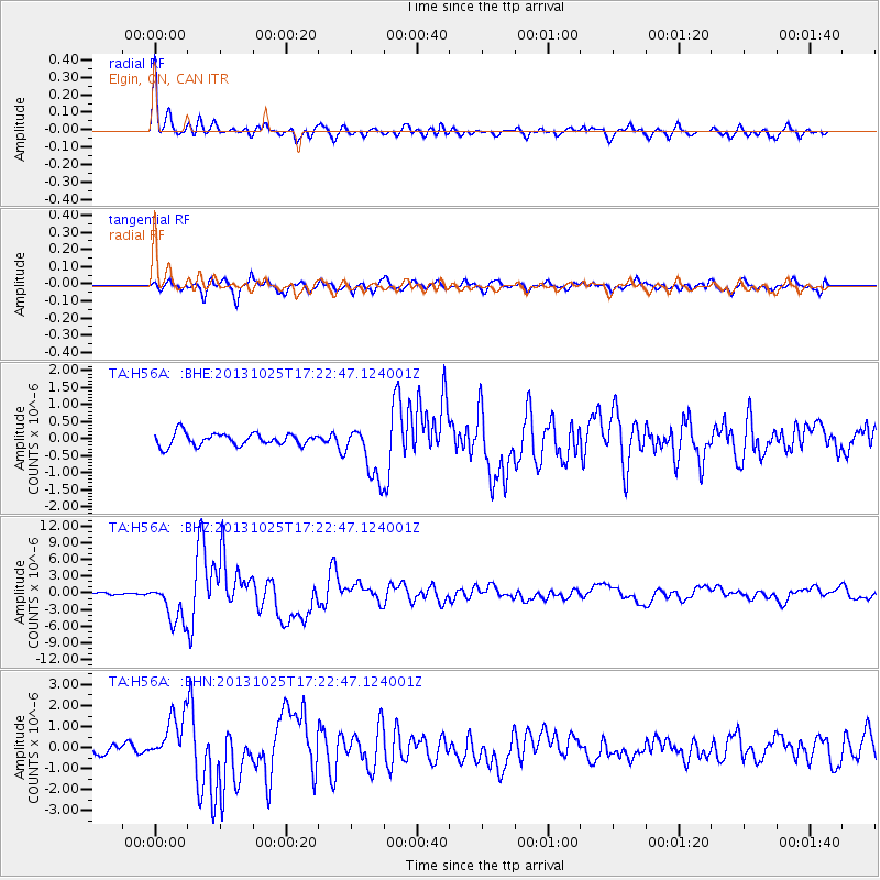
H56A Elgin, ON, CAN - Earthquake Result Viewer

Earthquake location: Off East Coast Of Honshu, Japan
Earthquake latitude/longitude: 37.2/144.7
Earthquake time(UTC): 2013/10/25 (298) 17:10:19 GMT
Earthquake Depth: 35 km
Earthquake Magnitude: 7.1 MWW, 7.1 MWW, 7.1 MWB, 7.1 MWC, 7.2 MWC, 7.5 MI
Earthquake Catalog/Contributor: NEIC PDE/NEIC COMCAT
Network: TA USArray Transportable Network (new EarthScope stations)
Station: H56A Elgin, ON, CAN
Lat/Lon: 44.59 N/76.26 W
Elevation: 137 m
Distance: 90.6 deg
Az: 27.905 deg
Baz: 328.443 deg
Ray Param: 0.041657224
Estimated Moho Depth: 63.25 km
Estimated Crust Vp/Vs: 1.69
Assumed Crust Vp: 6.577 km/s
Estimated Crust Vs: 3.892 km/s
Estimated Crust Poisson's Ratio: 0.23
Radial Match: 94.42374 %
Radial Bump: 400
Transverse Match: 82.49613 %
Transverse Bump: 400
SOD ConfigId: 626651
Insert Time: 2014-04-19 06:07:34.765 +0000
GWidth: 2.5
Max Bumps: 400
Tol: 0.001

Signal To Noise

ChannelStoNSTALTA
TA:H56A: :BHZ:20131025T17:22:47.124001Z9.8702673.6676815E-63.715889E-7
TA:H56A: :BHN:20131025T17:22:47.124001Z4.1893261.1382814E-62.7170992E-7
TA:H56A: :BHE:20131025T17:22:47.124001Z4.38708358.01153E-71.8261632E-7
Arrivals
Ps6.8 SECOND
PpPs25 SECOND
PsPs/PpSs32 SECOND