H63A New Sharon, ME, USA - Earthquake Result Viewer
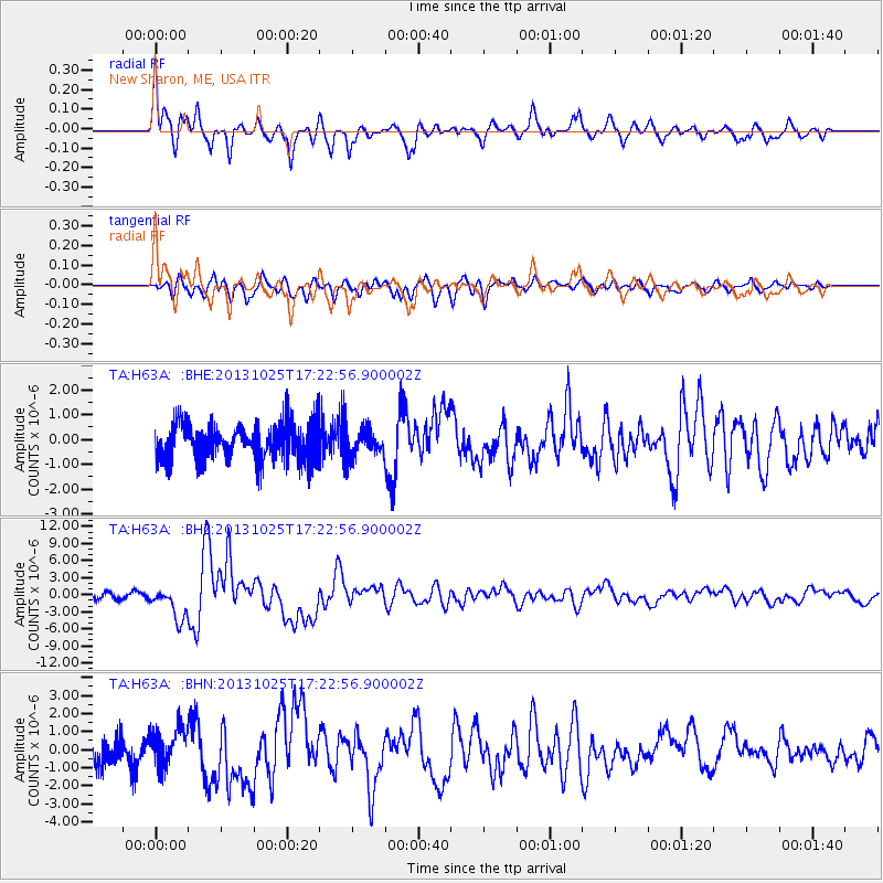
Earthquake location: Off East Coast Of Honshu, Japan
Earthquake latitude/longitude: 37.2/144.7
Earthquake time(UTC): 2013/10/25 (298) 17:10:19 GMT
Earthquake Depth: 35 km
Earthquake Magnitude: 7.1 MWW, 7.1 MWW, 7.1 MWB, 7.1 MWC, 7.2 MWC, 7.5 MI
Earthquake Catalog/Contributor: NEIC PDE/NEIC COMCAT
Network: TA USArray Transportable Network (new EarthScope stations)
Station: H63A New Sharon, ME, USA
Lat/Lon: 44.66 N/70.04 W
Elevation: 109 m
Distance: 92.7 deg
Az: 23.996 deg
Baz: 332.916 deg
Ray Param: 0.041390665
Estimated Moho Depth: 55.75 km
Estimated Crust Vp/Vs: 1.72
Assumed Crust Vp: 6.419 km/s
Estimated Crust Vs: 3.727 km/s
Estimated Crust Poisson's Ratio: 0.25
Radial Match: 80.22331 %
Radial Bump: 400
Transverse Match: 71.7601 %
Transverse Bump: 400
SOD ConfigId: 626651
Insert Time: 2014-04-19 06:07:54.035 +0000
GWidth: 2.5
Max Bumps: 400
Tol: 0.001

Signal To Noise

ChannelStoNSTALTA
TA:H63A: :BHZ:20131025T17:22:56.900002Z5.2072772.8282125E-65.43127E-7
TA:H63A: :BHN:20131025T17:22:56.900002Z1.52907671.0631863E-66.953126E-7
TA:H63A: :BHE:20131025T17:22:56.900002Z0.74290085.536959E-77.453161E-7
Arrivals
Ps6.4 SECOND
PpPs23 SECOND
PsPs/PpSs30 SECOND