I41A Arkdale, WI, USA - Earthquake Result Viewer
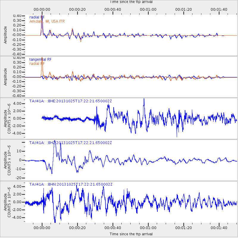
Earthquake location: Off East Coast Of Honshu, Japan
Earthquake latitude/longitude: 37.2/144.7
Earthquake time(UTC): 2013/10/25 (298) 17:10:19 GMT
Earthquake Depth: 35 km
Earthquake Magnitude: 7.1 MWW, 7.1 MWW, 7.1 MWB, 7.1 MWC, 7.2 MWC, 7.5 MI
Earthquake Catalog/Contributor: NEIC PDE/NEIC COMCAT
Network: TA USArray Transportable Network (new EarthScope stations)
Station: I41A Arkdale, WI, USA
Lat/Lon: 44.06 N/89.87 W
Elevation: 289 m
Distance: 85.3 deg
Az: 36.098 deg
Baz: 319.239 deg
Ray Param: 0.044840656
Estimated Moho Depth: 43.0 km
Estimated Crust Vp/Vs: 1.67
Assumed Crust Vp: 6.41 km/s
Estimated Crust Vs: 3.844 km/s
Estimated Crust Poisson's Ratio: 0.22
Radial Match: 96.85107 %
Radial Bump: 400
Transverse Match: 82.410706 %
Transverse Bump: 400
SOD ConfigId: 626651
Insert Time: 2014-04-19 06:08:15.524 +0000
GWidth: 2.5
Max Bumps: 400
Tol: 0.001

Signal To Noise

ChannelStoNSTALTA
TA:I41A: :BHZ:20131025T17:22:21.650002Z17.2227295.2798227E-63.0656133E-7
TA:I41A: :BHN:20131025T17:22:21.650002Z3.82636861.4573856E-63.8087956E-7
TA:I41A: :BHE:20131025T17:22:21.650002Z3.95580551.3711247E-63.4661073E-7
Arrivals
Ps4.6 SECOND
PpPs17 SECOND
PsPs/PpSs22 SECOND