I42A Draeger Farm, Ripon, WI, USA - Earthquake Result Viewer
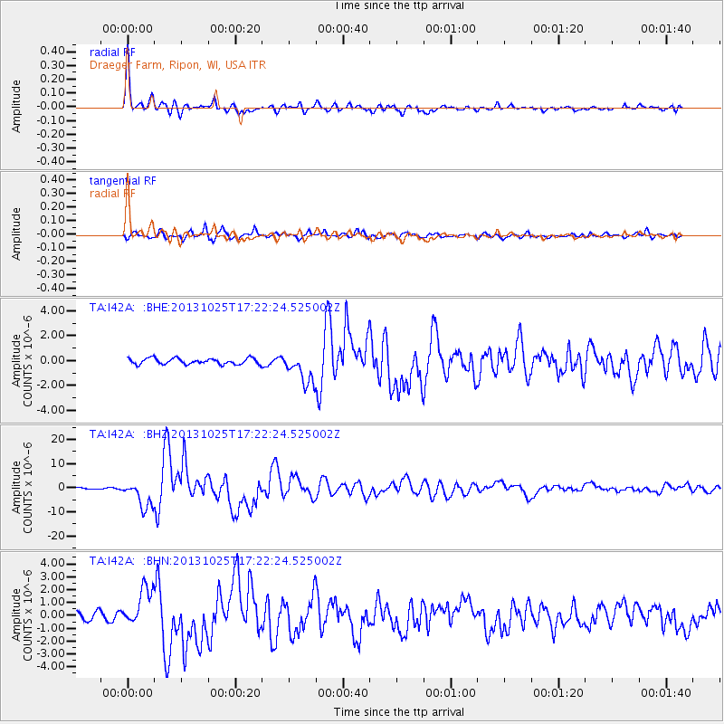
Earthquake location: Off East Coast Of Honshu, Japan
Earthquake latitude/longitude: 37.2/144.7
Earthquake time(UTC): 2013/10/25 (298) 17:10:19 GMT
Earthquake Depth: 35 km
Earthquake Magnitude: 7.1 MWW, 7.1 MWW, 7.1 MWB, 7.1 MWC, 7.2 MWC, 7.5 MI
Earthquake Catalog/Contributor: NEIC PDE/NEIC COMCAT
Network: TA USArray Transportable Network (new EarthScope stations)
Station: I42A Draeger Farm, Ripon, WI, USA
Lat/Lon: 43.89 N/88.91 W
Elevation: 298 m
Distance: 85.8 deg
Az: 35.681 deg
Baz: 319.868 deg
Ray Param: 0.04442872
Estimated Moho Depth: 39.5 km
Estimated Crust Vp/Vs: 1.75
Assumed Crust Vp: 6.571 km/s
Estimated Crust Vs: 3.744 km/s
Estimated Crust Poisson's Ratio: 0.26
Radial Match: 95.86581 %
Radial Bump: 400
Transverse Match: 87.17516 %
Transverse Bump: 400
SOD ConfigId: 626651
Insert Time: 2014-04-19 06:08:19.025 +0000
GWidth: 2.5
Max Bumps: 400
Tol: 0.001

Signal To Noise

ChannelStoNSTALTA
TA:I42A: :BHZ:20131025T17:22:24.525002Z19.7395975.6309186E-62.8526006E-7
TA:I42A: :BHN:20131025T17:22:24.525002Z4.6940011.4588016E-63.1077997E-7
TA:I42A: :BHE:20131025T17:22:24.525002Z5.3372931.2573005E-62.3556895E-7
Arrivals
Ps4.7 SECOND
PpPs16 SECOND
PsPs/PpSs21 SECOND