I61A Oroboro, Fairlee, VT, USA - Earthquake Result Viewer
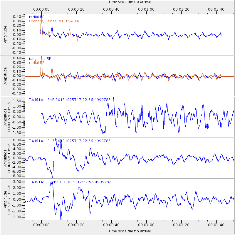
Earthquake location: Off East Coast Of Honshu, Japan
Earthquake latitude/longitude: 37.2/144.7
Earthquake time(UTC): 2013/10/25 (298) 17:10:19 GMT
Earthquake Depth: 35 km
Earthquake Magnitude: 7.1 MWW, 7.1 MWW, 7.1 MWB, 7.1 MWC, 7.2 MWC, 7.5 MI
Earthquake Catalog/Contributor: NEIC PDE/NEIC COMCAT
Network: TA USArray Transportable Network (new EarthScope stations)
Station: I61A Oroboro, Fairlee, VT, USA
Lat/Lon: 43.93 N/72.21 W
Elevation: 287 m
Distance: 92.6 deg
Az: 25.718 deg
Baz: 331.323 deg
Ray Param: 0.041407544
Estimated Moho Depth: 59.75 km
Estimated Crust Vp/Vs: 1.64
Assumed Crust Vp: 6.419 km/s
Estimated Crust Vs: 3.908 km/s
Estimated Crust Poisson's Ratio: 0.21
Radial Match: 85.274506 %
Radial Bump: 400
Transverse Match: 70.84863 %
Transverse Bump: 400
SOD ConfigId: 626651
Insert Time: 2014-04-19 06:08:55.933 +0000
GWidth: 2.5
Max Bumps: 400
Tol: 0.001

Signal To Noise

ChannelStoNSTALTA
TA:I61A: :BHZ:20131025T17:22:56.499978Z6.1008682.5385327E-64.1609368E-7
TA:I61A: :BHN:20131025T17:22:56.499978Z2.1071536.4972136E-73.0834084E-7
TA:I61A: :BHE:20131025T17:22:56.499978Z1.90620585.8238385E-73.0551993E-7
Arrivals
Ps6.1 SECOND
PpPs24 SECOND
PsPs/PpSs30 SECOND