J05D Fort Rock, OR, USA - Earthquake Result Viewer
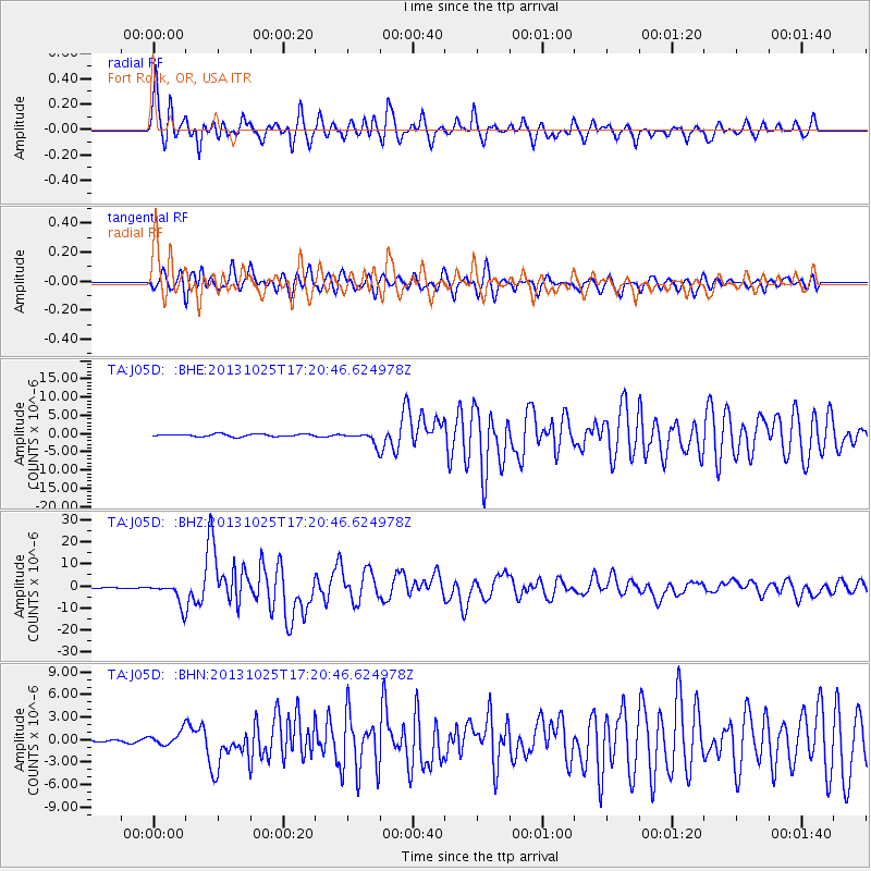
Earthquake location: Off East Coast Of Honshu, Japan
Earthquake latitude/longitude: 37.2/144.7
Earthquake time(UTC): 2013/10/25 (298) 17:10:19 GMT
Earthquake Depth: 35 km
Earthquake Magnitude: 7.1 MWW, 7.1 MWW, 7.1 MWB, 7.1 MWC, 7.2 MWC, 7.5 MI
Earthquake Catalog/Contributor: NEIC PDE/NEIC COMCAT
Network: TA USArray Transportable Network (new EarthScope stations)
Station: J05D Fort Rock, OR, USA
Lat/Lon: 43.28 N/121.23 W
Elevation: 1541 m
Distance: 68.3 deg
Az: 51.602 deg
Baz: 300.969 deg
Ray Param: 0.05631307
Estimated Moho Depth: 23.5 km
Estimated Crust Vp/Vs: 1.69
Assumed Crust Vp: 6.597 km/s
Estimated Crust Vs: 3.915 km/s
Estimated Crust Poisson's Ratio: 0.23
Radial Match: 93.1462 %
Radial Bump: 400
Transverse Match: 88.22705 %
Transverse Bump: 400
SOD ConfigId: 626651
Insert Time: 2014-04-19 06:09:11.970 +0000
GWidth: 2.5
Max Bumps: 400
Tol: 0.001

Signal To Noise

ChannelStoNSTALTA
TA:J05D: :BHZ:20131025T17:20:46.624978Z18.9032065.183107E-62.7419196E-7
TA:J05D: :BHN:20131025T17:20:46.624978Z4.30183469.146197E-72.1261155E-7
TA:J05D: :BHE:20131025T17:20:46.624978Z4.82786851.6197412E-63.3549819E-7
Arrivals
Ps2.5 SECOND
PpPs9.2 SECOND
PsPs/PpSs12 SECOND