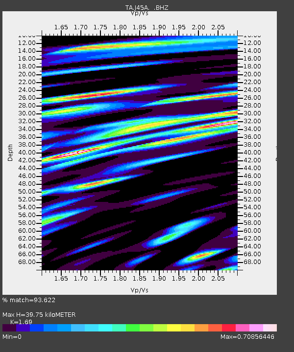
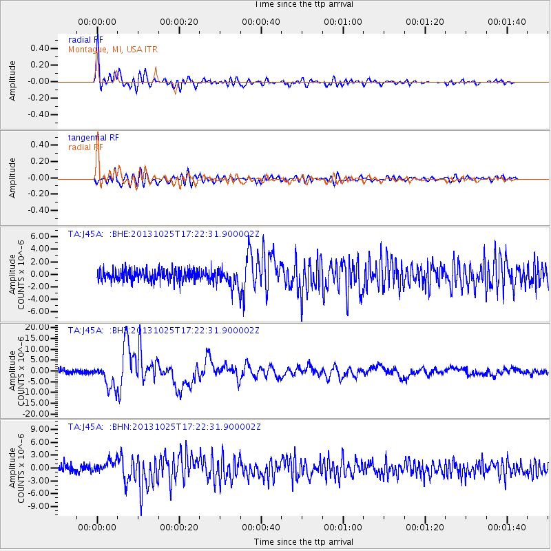
J45A Montague, MI, USA - Earthquake Result Viewer

Earthquake location: Off East Coast Of Honshu, Japan
Earthquake latitude/longitude: 37.2/144.7
Earthquake time(UTC): 2013/10/25 (298) 17:10:19 GMT
Earthquake Depth: 35 km
Earthquake Magnitude: 7.1 MWW, 7.1 MWW, 7.1 MWB, 7.1 MWC, 7.2 MWC, 7.5 MI
Earthquake Catalog/Contributor: NEIC PDE/NEIC COMCAT
Network: TA USArray Transportable Network (new EarthScope stations)
Station: J45A Montague, MI, USA
Lat/Lon: 43.44 N/86.39 W
Elevation: 209 m
Distance: 87.4 deg
Az: 34.549 deg
Baz: 321.538 deg
Ray Param: 0.043339565
Estimated Moho Depth: 39.75 km
Estimated Crust Vp/Vs: 1.69
Assumed Crust Vp: 6.483 km/s
Estimated Crust Vs: 3.836 km/s
Estimated Crust Poisson's Ratio: 0.23
Radial Match: 93.622 %
Radial Bump: 400
Transverse Match: 82.25602 %
Transverse Bump: 400
SOD ConfigId: 626651
Insert Time: 2014-04-19 06:09:17.316 +0000
GWidth: 2.5
Max Bumps: 400
Tol: 0.001

Signal To Noise

ChannelStoNSTALTA
TA:J45A: :BHZ:20131025T17:22:31.900002Z5.80312825.605955E-69.660229E-7
TA:J45A: :BHN:20131025T17:22:31.900002Z1.88671141.4667733E-67.774232E-7
TA:J45A: :BHE:20131025T17:22:31.900002Z1.7326441.5096286E-68.7128615E-7
Arrivals
Ps4.3 SECOND
PpPs16 SECOND
PsPs/PpSs20 SECOND