J47A Sunmer, MI, USA - Earthquake Result Viewer
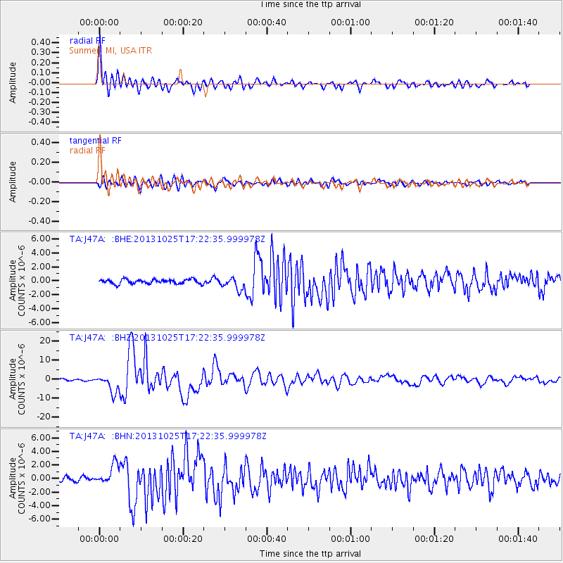
Earthquake location: Off East Coast Of Honshu, Japan
Earthquake latitude/longitude: 37.2/144.7
Earthquake time(UTC): 2013/10/25 (298) 17:10:19 GMT
Earthquake Depth: 35 km
Earthquake Magnitude: 7.1 MWW, 7.1 MWW, 7.1 MWB, 7.1 MWC, 7.2 MWC, 7.5 MI
Earthquake Catalog/Contributor: NEIC PDE/NEIC COMCAT
Network: TA USArray Transportable Network (new EarthScope stations)
Station: J47A Sunmer, MI, USA
Lat/Lon: 43.24 N/84.82 W
Elevation: 236 m
Distance: 88.2 deg
Az: 33.768 deg
Baz: 322.58 deg
Ray Param: 0.042707372
Estimated Moho Depth: 46.75 km
Estimated Crust Vp/Vs: 1.60
Assumed Crust Vp: 6.483 km/s
Estimated Crust Vs: 4.052 km/s
Estimated Crust Poisson's Ratio: 0.18
Radial Match: 95.001945 %
Radial Bump: 400
Transverse Match: 87.83152 %
Transverse Bump: 400
SOD ConfigId: 626651
Insert Time: 2014-04-19 06:09:22.754 +0000
GWidth: 2.5
Max Bumps: 400
Tol: 0.001

Signal To Noise

ChannelStoNSTALTA
TA:J47A: :BHZ:20131025T17:22:35.999978Z11.7086254.7764825E-64.0794566E-7
TA:J47A: :BHN:20131025T17:22:35.999978Z4.05243161.5528719E-63.831951E-7
TA:J47A: :BHE:20131025T17:22:35.999978Z2.9657968.979292E-73.0276163E-7
Arrivals
Ps4.4 SECOND
PpPs18 SECOND
PsPs/PpSs23 SECOND