J56A Wolcott, NY, USA - Earthquake Result Viewer
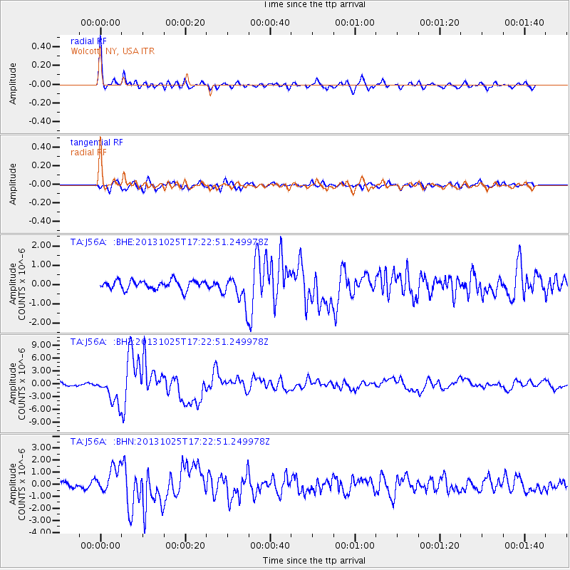
Earthquake location: Off East Coast Of Honshu, Japan
Earthquake latitude/longitude: 37.2/144.7
Earthquake time(UTC): 2013/10/25 (298) 17:10:19 GMT
Earthquake Depth: 35 km
Earthquake Magnitude: 7.1 MWW, 7.1 MWW, 7.1 MWB, 7.1 MWC, 7.2 MWC, 7.5 MI
Earthquake Catalog/Contributor: NEIC PDE/NEIC COMCAT
Network: TA USArray Transportable Network (new EarthScope stations)
Station: J56A Wolcott, NY, USA
Lat/Lon: 43.28 N/76.86 W
Elevation: 93 m
Distance: 91.5 deg
Az: 28.966 deg
Baz: 328.01 deg
Ray Param: 0.04159187
Estimated Moho Depth: 35.0 km
Estimated Crust Vp/Vs: 2.02
Assumed Crust Vp: 6.476 km/s
Estimated Crust Vs: 3.214 km/s
Estimated Crust Poisson's Ratio: 0.34
Radial Match: 91.69713 %
Radial Bump: 364
Transverse Match: 81.46958 %
Transverse Bump: 400
SOD ConfigId: 626651
Insert Time: 2014-04-19 06:09:37.684 +0000
GWidth: 2.5
Max Bumps: 400
Tol: 0.001

Signal To Noise

ChannelStoNSTALTA
TA:J56A: :BHZ:20131025T17:22:51.249978Z11.0405753.3336248E-63.0194303E-7
TA:J56A: :BHN:20131025T17:22:51.249978Z3.94337421.0952243E-62.7773785E-7
TA:J56A: :BHE:20131025T17:22:51.249978Z3.2845167.718691E-72.3500239E-7
Arrivals
Ps5.6 SECOND
PpPs16 SECOND
PsPs/PpSs22 SECOND