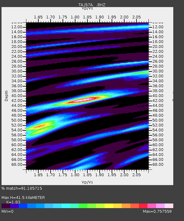
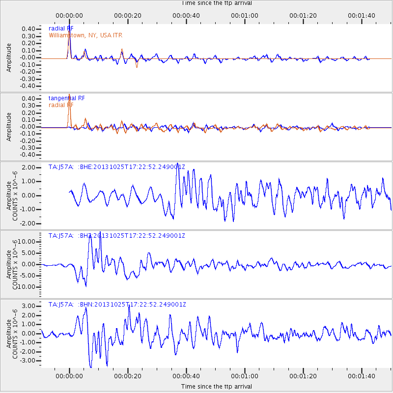
J57A Williamstown, NY, USA - Earthquake Result Viewer

Earthquake location: Off East Coast Of Honshu, Japan
Earthquake latitude/longitude: 37.2/144.7
Earthquake time(UTC): 2013/10/25 (298) 17:10:19 GMT
Earthquake Depth: 35 km
Earthquake Magnitude: 7.1 MWW, 7.1 MWW, 7.1 MWB, 7.1 MWC, 7.2 MWC, 7.5 MI
Earthquake Catalog/Contributor: NEIC PDE/NEIC COMCAT
Network: TA USArray Transportable Network (new EarthScope stations)
Station: J57A Williamstown, NY, USA
Lat/Lon: 43.41 N/76.00 W
Elevation: 191 m
Distance: 91.7 deg
Az: 28.361 deg
Baz: 328.616 deg
Ray Param: 0.041559123
Estimated Moho Depth: 41.5 km
Estimated Crust Vp/Vs: 1.83
Assumed Crust Vp: 6.419 km/s
Estimated Crust Vs: 3.508 km/s
Estimated Crust Poisson's Ratio: 0.29
Radial Match: 91.185715 %
Radial Bump: 281
Transverse Match: 69.94872 %
Transverse Bump: 400
SOD ConfigId: 626651
Insert Time: 2014-04-19 06:09:38.303 +0000
GWidth: 2.5
Max Bumps: 400
Tol: 0.001

Signal To Noise

ChannelStoNSTALTA
TA:J57A: :BHZ:20131025T17:22:52.249001Z7.74522543.461808E-64.4696029E-7
TA:J57A: :BHN:20131025T17:22:52.249001Z3.48526489.524973E-72.7329267E-7
TA:J57A: :BHE:20131025T17:22:52.249001Z1.859117.267812E-73.9092964E-7
Arrivals
Ps5.5 SECOND
PpPs18 SECOND
PsPs/PpSs23 SECOND