
J61A Chester, VT, USA - Earthquake Result Viewer
| ||||||||||||||||||
| ||||||||||||||||||
| ||||||||||||||||||
|
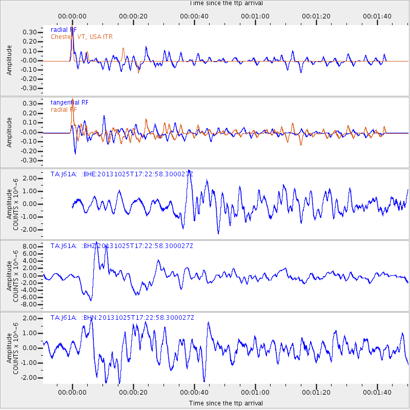
Signal To Noise
| Channel | StoN | STA | LTA |
| TA:J61A: :BHZ:20131025T17:22:58.300027Z | 5.67992 | 2.5669835E-6 | 4.5194005E-7 |
| TA:J61A: :BHN:20131025T17:22:58.300027Z | 1.9931421 | 7.572118E-7 | 3.7990858E-7 |
| TA:J61A: :BHE:20131025T17:22:58.300027Z | 1.1826547 | 5.042368E-7 | 4.2636012E-7 |
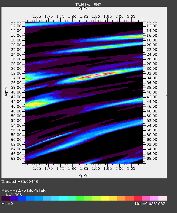
| Arrivals | |
| Ps | 4.7 SECOND |
| PpPs | 14 SECOND |
| PsPs/PpSs | 19 SECOND |

