K62A Royalston, MA, USA - Earthquake Result Viewer
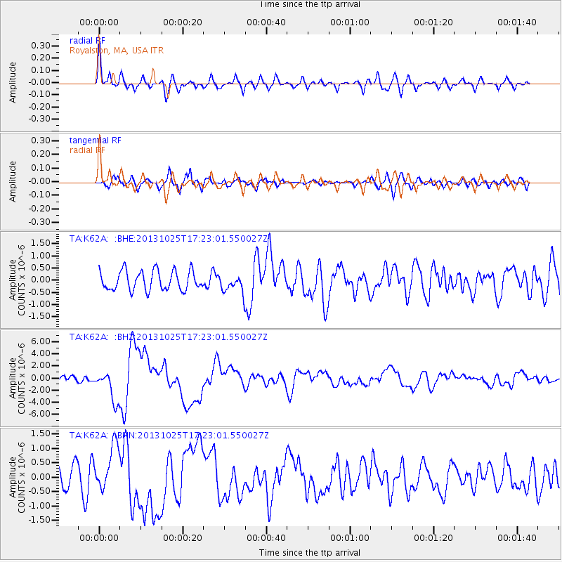
Earthquake location: Off East Coast Of Honshu, Japan
Earthquake latitude/longitude: 37.2/144.7
Earthquake time(UTC): 2013/10/25 (298) 17:10:19 GMT
Earthquake Depth: 35 km
Earthquake Magnitude: 7.1 MWW, 7.1 MWW, 7.1 MWB, 7.1 MWC, 7.2 MWC, 7.5 MI
Earthquake Catalog/Contributor: NEIC PDE/NEIC COMCAT
Network: TA USArray Transportable Network (new EarthScope stations)
Station: K62A Royalston, MA, USA
Lat/Lon: 42.67 N/72.23 W
Elevation: 289 m
Distance: 93.7 deg
Az: 26.344 deg
Baz: 331.27 deg
Ray Param: 0.04118969
Estimated Moho Depth: 40.75 km
Estimated Crust Vp/Vs: 1.85
Assumed Crust Vp: 6.419 km/s
Estimated Crust Vs: 3.47 km/s
Estimated Crust Poisson's Ratio: 0.29
Radial Match: 80.603836 %
Radial Bump: 400
Transverse Match: 63.382523 %
Transverse Bump: 400
SOD ConfigId: 626651
Insert Time: 2014-04-19 06:10:55.185 +0000
GWidth: 2.5
Max Bumps: 400
Tol: 0.001

Signal To Noise

ChannelStoNSTALTA
TA:K62A: :BHZ:20131025T17:23:01.550027Z6.2827482.6132586E-64.1594197E-7
TA:K62A: :BHN:20131025T17:23:01.550027Z2.0421938.170261E-74.0007293E-7
TA:K62A: :BHE:20131025T17:23:01.550027Z0.941234233.7558053E-73.9902983E-7
Arrivals
Ps5.5 SECOND
PpPs18 SECOND
PsPs/PpSs23 SECOND