K63A Dunstable, MA, USA - Earthquake Result Viewer
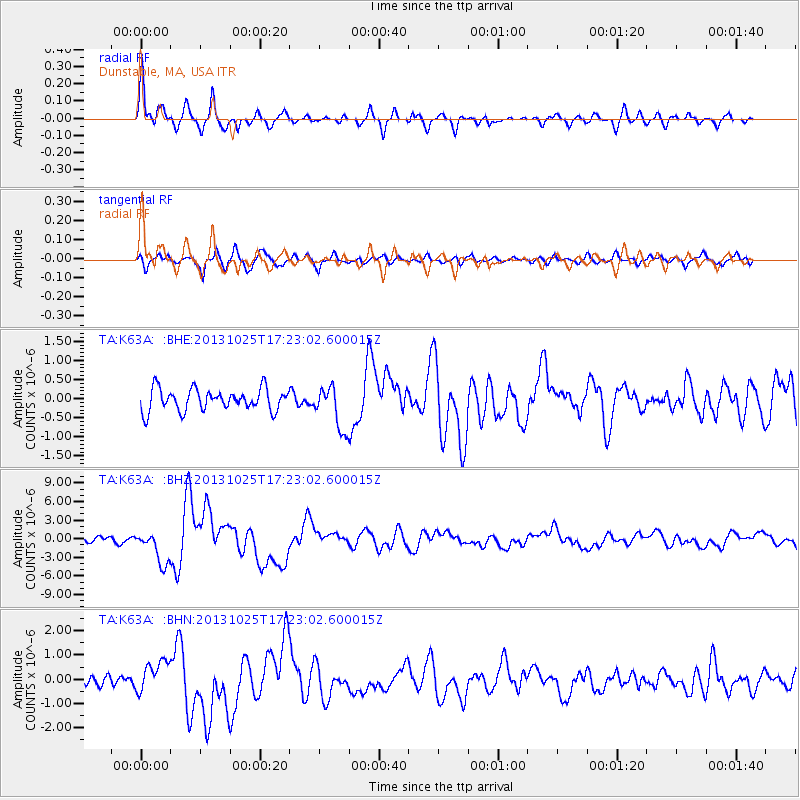
Earthquake location: Off East Coast Of Honshu, Japan
Earthquake latitude/longitude: 37.2/144.7
Earthquake time(UTC): 2013/10/25 (298) 17:10:19 GMT
Earthquake Depth: 35 km
Earthquake Magnitude: 7.1 MWW, 7.1 MWW, 7.1 MWB, 7.1 MWC, 7.2 MWC, 7.5 MI
Earthquake Catalog/Contributor: NEIC PDE/NEIC COMCAT
Network: TA USArray Transportable Network (new EarthScope stations)
Station: K63A Dunstable, MA, USA
Lat/Lon: 42.69 N/71.53 W
Elevation: 68 m
Distance: 94.0 deg
Az: 25.874 deg
Baz: 331.779 deg
Ray Param: 0.041139778
Estimated Moho Depth: 30.25 km
Estimated Crust Vp/Vs: 1.62
Assumed Crust Vp: 6.419 km/s
Estimated Crust Vs: 3.969 km/s
Estimated Crust Poisson's Ratio: 0.19
Radial Match: 82.73479 %
Radial Bump: 400
Transverse Match: 66.64291 %
Transverse Bump: 400
SOD ConfigId: 626651
Insert Time: 2014-04-19 06:10:56.474 +0000
GWidth: 2.5
Max Bumps: 400
Tol: 0.001

Signal To Noise

ChannelStoNSTALTA
TA:K63A: :BHZ:20131025T17:23:02.600015Z6.21253822.6765717E-64.3083384E-7
TA:K63A: :BHN:20131025T17:23:02.600015Z2.34852536.359325E-72.7077948E-7
TA:K63A: :BHE:20131025T17:23:02.600015Z1.98706845.6620695E-72.8494588E-7
Arrivals
Ps3.0 SECOND
PpPs12 SECOND
PsPs/PpSs15 SECOND