
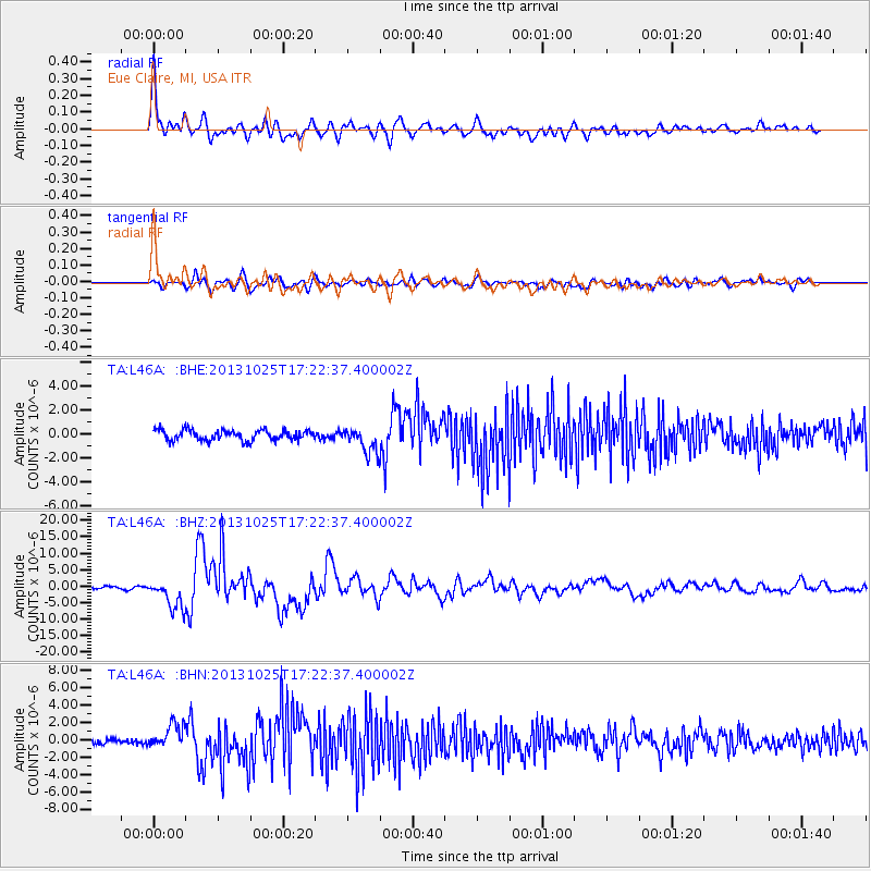
L46A Eue Claire, MI, USA - Earthquake Result Viewer
| ||||||||||||||||||
| ||||||||||||||||||
| ||||||||||||||||||
|
Signal To Noise
| Channel | StoN | STA | LTA |
| TA:L46A: :BHZ:20131025T17:22:37.400002Z | 10.502779 | 4.5525753E-6 | 4.334639E-7 |
| TA:L46A: :BHN:20131025T17:22:37.400002Z | 4.070518 | 1.3535309E-6 | 3.3252056E-7 |
| TA:L46A: :BHE:20131025T17:22:37.400002Z | 2.4712296 | 1.0792455E-6 | 4.367241E-7 |
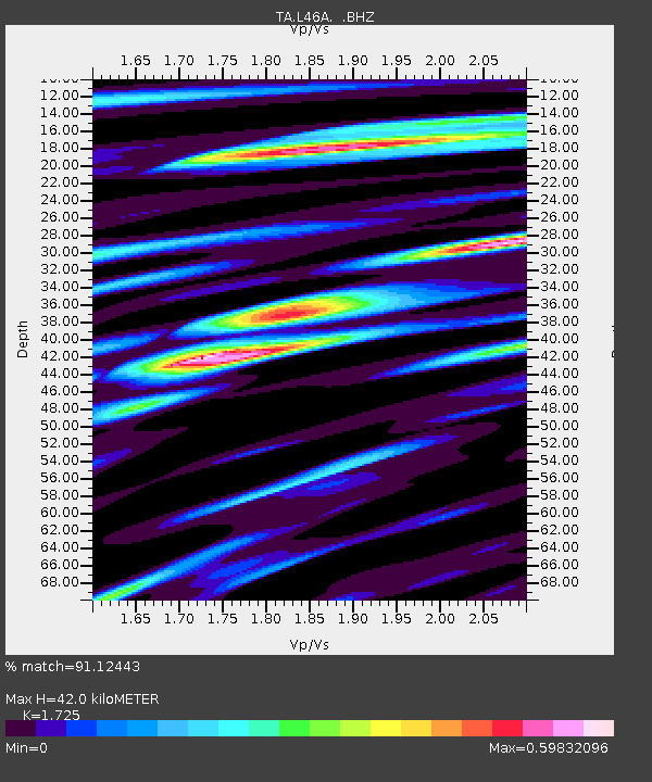
| Arrivals | |
| Ps | 4.8 SECOND |
| PpPs | 17 SECOND |
| PsPs/PpSs | 22 SECOND |

