L50A Kingsville, ON, CAN - Earthquake Result Viewer
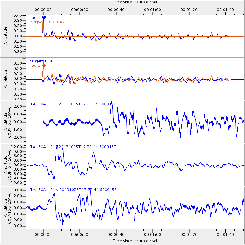
Earthquake location: Off East Coast Of Honshu, Japan
Earthquake latitude/longitude: 37.2/144.7
Earthquake time(UTC): 2013/10/25 (298) 17:10:19 GMT
Earthquake Depth: 35 km
Earthquake Magnitude: 7.1 MWW, 7.1 MWW, 7.1 MWB, 7.1 MWC, 7.2 MWC, 7.5 MI
Earthquake Catalog/Contributor: NEIC PDE/NEIC COMCAT
Network: TA USArray Transportable Network (new EarthScope stations)
Station: L50A Kingsville, ON, CAN
Lat/Lon: 42.04 N/82.81 W
Elevation: 187 m
Distance: 90.1 deg
Az: 33.293 deg
Baz: 323.93 deg
Ray Param: 0.041696116
Estimated Moho Depth: 34.0 km
Estimated Crust Vp/Vs: 1.70
Assumed Crust Vp: 6.483 km/s
Estimated Crust Vs: 3.813 km/s
Estimated Crust Poisson's Ratio: 0.24
Radial Match: 93.639046 %
Radial Bump: 400
Transverse Match: 87.737625 %
Transverse Bump: 400
SOD ConfigId: 626651
Insert Time: 2014-04-19 06:11:23.188 +0000
GWidth: 2.5
Max Bumps: 400
Tol: 0.001

Signal To Noise

ChannelStoNSTALTA
TA:L50A: :BHZ:20131025T17:22:44.600015Z11.1231873.225201E-62.8995294E-7
TA:L50A: :BHN:20131025T17:22:44.600015Z2.92391188.1415413E-72.784469E-7
TA:L50A: :BHE:20131025T17:22:44.600015Z3.76885918.127585E-72.1565107E-7
Arrivals
Ps3.8 SECOND
PpPs14 SECOND
PsPs/PpSs18 SECOND