L54A Sinclairville, NY, USA - Earthquake Result Viewer
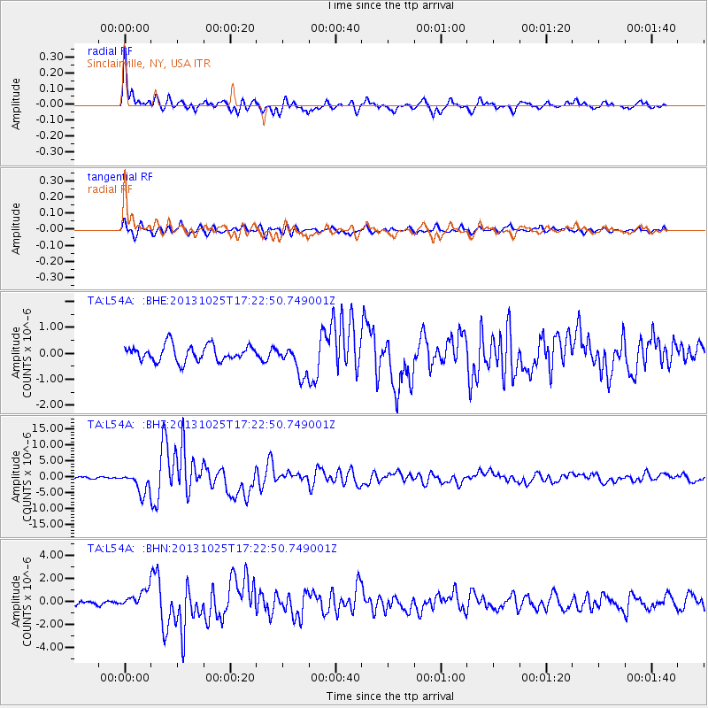
Earthquake location: Off East Coast Of Honshu, Japan
Earthquake latitude/longitude: 37.2/144.7
Earthquake time(UTC): 2013/10/25 (298) 17:10:19 GMT
Earthquake Depth: 35 km
Earthquake Magnitude: 7.1 MWW, 7.1 MWW, 7.1 MWB, 7.1 MWC, 7.2 MWC, 7.5 MI
Earthquake Catalog/Contributor: NEIC PDE/NEIC COMCAT
Network: TA USArray Transportable Network (new EarthScope stations)
Station: L54A Sinclairville, NY, USA
Lat/Lon: 42.23 N/79.32 W
Elevation: 432 m
Distance: 91.4 deg
Az: 31.052 deg
Baz: 326.294 deg
Ray Param: 0.041601323
Estimated Moho Depth: 15.25 km
Estimated Crust Vp/Vs: 1.60
Assumed Crust Vp: 6.419 km/s
Estimated Crust Vs: 4.012 km/s
Estimated Crust Poisson's Ratio: 0.18
Radial Match: 94.48038 %
Radial Bump: 399
Transverse Match: 82.9722 %
Transverse Bump: 400
SOD ConfigId: 626651
Insert Time: 2014-04-19 06:11:28.394 +0000
GWidth: 2.5
Max Bumps: 400
Tol: 0.001

Signal To Noise

ChannelStoNSTALTA
TA:L54A: :BHZ:20131025T17:22:50.749001Z10.9918183.4153736E-63.1071963E-7
TA:L54A: :BHN:20131025T17:22:50.749001Z3.1058737.4844144E-72.409762E-7
TA:L54A: :BHE:20131025T17:22:50.749001Z1.97573465.9754194E-73.0244038E-7
Arrivals
Ps1.5 SECOND
PpPs6.0 SECOND
PsPs/PpSs7.5 SECOND