L60A Shokan, NY, USA - Earthquake Result Viewer
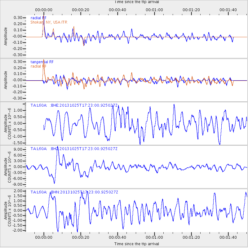
Earthquake location: Off East Coast Of Honshu, Japan
Earthquake latitude/longitude: 37.2/144.7
Earthquake time(UTC): 2013/10/25 (298) 17:10:19 GMT
Earthquake Depth: 35 km
Earthquake Magnitude: 7.1 MWW, 7.1 MWW, 7.1 MWB, 7.1 MWC, 7.2 MWC, 7.5 MI
Earthquake Catalog/Contributor: NEIC PDE/NEIC COMCAT
Network: TA USArray Transportable Network (new EarthScope stations)
Station: L60A Shokan, NY, USA
Lat/Lon: 41.99 N/74.22 W
Elevation: 388 m
Distance: 93.6 deg
Az: 27.963 deg
Baz: 329.833 deg
Ray Param: 0.04121668
Estimated Moho Depth: 41.75 km
Estimated Crust Vp/Vs: 1.75
Assumed Crust Vp: 6.283 km/s
Estimated Crust Vs: 3.59 km/s
Estimated Crust Poisson's Ratio: 0.26
Radial Match: 80.94615 %
Radial Bump: 400
Transverse Match: 66.44183 %
Transverse Bump: 400
SOD ConfigId: 626651
Insert Time: 2014-04-19 06:11:43.559 +0000
GWidth: 2.5
Max Bumps: 400
Tol: 0.001

Signal To Noise

ChannelStoNSTALTA
TA:L60A: :BHZ:20131025T17:23:00.925027Z3.35577082.7125272E-68.083172E-7
TA:L60A: :BHN:20131025T17:23:00.925027Z3.95476061.0022613E-62.534316E-7
TA:L60A: :BHE:20131025T17:23:00.925027Z1.16357436.871142E-75.9052024E-7
Arrivals
Ps5.1 SECOND
PpPs18 SECOND
PsPs/PpSs23 SECOND