M44A Midewin, Midewin Nat. Tallgrass Prarie, IL, USA - Earthquake Result Viewer
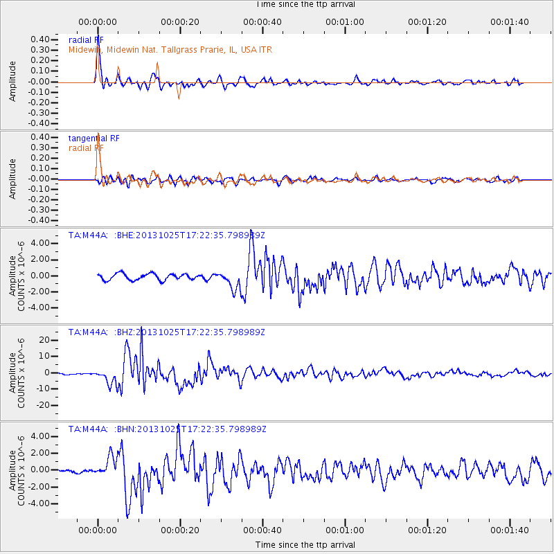
Earthquake location: Off East Coast Of Honshu, Japan
Earthquake latitude/longitude: 37.2/144.7
Earthquake time(UTC): 2013/10/25 (298) 17:10:19 GMT
Earthquake Depth: 35 km
Earthquake Magnitude: 7.1 MWW, 7.1 MWW, 7.1 MWB, 7.1 MWC, 7.2 MWC, 7.5 MI
Earthquake Catalog/Contributor: NEIC PDE/NEIC COMCAT
Network: TA USArray Transportable Network (new EarthScope stations)
Station: M44A Midewin, Midewin Nat. Tallgrass Prarie, IL, USA
Lat/Lon: 41.39 N/88.04 W
Elevation: 207 m
Distance: 88.2 deg
Az: 36.79 deg
Baz: 320.513 deg
Ray Param: 0.042736124
Estimated Moho Depth: 28.25 km
Estimated Crust Vp/Vs: 2.10
Assumed Crust Vp: 6.498 km/s
Estimated Crust Vs: 3.101 km/s
Estimated Crust Poisson's Ratio: 0.35
Radial Match: 95.78096 %
Radial Bump: 363
Transverse Match: 83.79273 %
Transverse Bump: 400
SOD ConfigId: 626651
Insert Time: 2014-04-19 06:12:06.415 +0000
GWidth: 2.5
Max Bumps: 400
Tol: 0.001

Signal To Noise

ChannelStoNSTALTA
TA:M44A: :BHZ:20131025T17:22:35.798989Z11.7112854.934359E-64.213337E-7
TA:M44A: :BHN:20131025T17:22:35.798989Z4.6966681.2951516E-62.7575967E-7
TA:M44A: :BHE:20131025T17:22:35.798989Z2.99158861.181403E-63.9490826E-7
Arrivals
Ps4.9 SECOND
PpPs13 SECOND
PsPs/PpSs18 SECOND