M51A Elyria, OH, USA - Earthquake Result Viewer
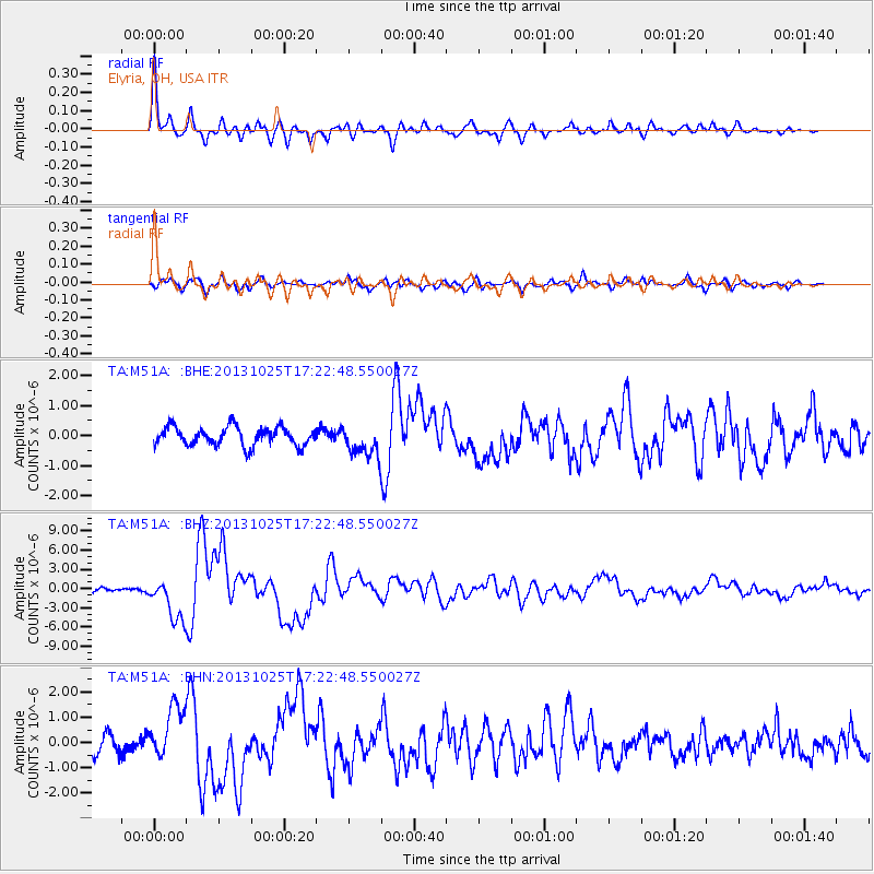
Earthquake location: Off East Coast Of Honshu, Japan
Earthquake latitude/longitude: 37.2/144.7
Earthquake time(UTC): 2013/10/25 (298) 17:10:19 GMT
Earthquake Depth: 35 km
Earthquake Magnitude: 7.1 MWW, 7.1 MWW, 7.1 MWB, 7.1 MWC, 7.2 MWC, 7.5 MI
Earthquake Catalog/Contributor: NEIC PDE/NEIC COMCAT
Network: TA USArray Transportable Network (new EarthScope stations)
Station: M51A Elyria, OH, USA
Lat/Lon: 41.33 N/82.18 W
Elevation: 239 m
Distance: 90.9 deg
Az: 33.329 deg
Baz: 324.345 deg
Ray Param: 0.04163546
Estimated Moho Depth: 12.5 km
Estimated Crust Vp/Vs: 2.10
Assumed Crust Vp: 6.498 km/s
Estimated Crust Vs: 3.101 km/s
Estimated Crust Poisson's Ratio: 0.35
Radial Match: 91.24963 %
Radial Bump: 400
Transverse Match: 71.3452 %
Transverse Bump: 400
SOD ConfigId: 626651
Insert Time: 2014-04-19 06:12:17.808 +0000
GWidth: 2.5
Max Bumps: 400
Tol: 0.001

Signal To Noise

ChannelStoNSTALTA
TA:M51A: :BHZ:20131025T17:22:48.550027Z9.7736853.319993E-63.3968692E-7
TA:M51A: :BHN:20131025T17:22:48.550027Z3.49915391.0865917E-63.1052986E-7
TA:M51A: :BHE:20131025T17:22:48.550027Z1.72123445.34427E-73.1049052E-7
Arrivals
Ps2.1 SECOND
PpPs5.8 SECOND
PsPs/PpSs8.0 SECOND