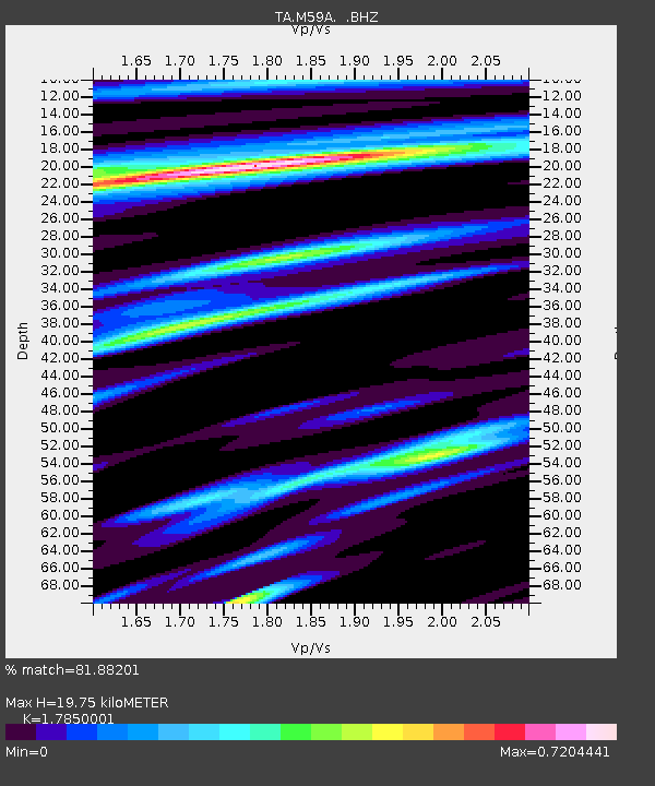
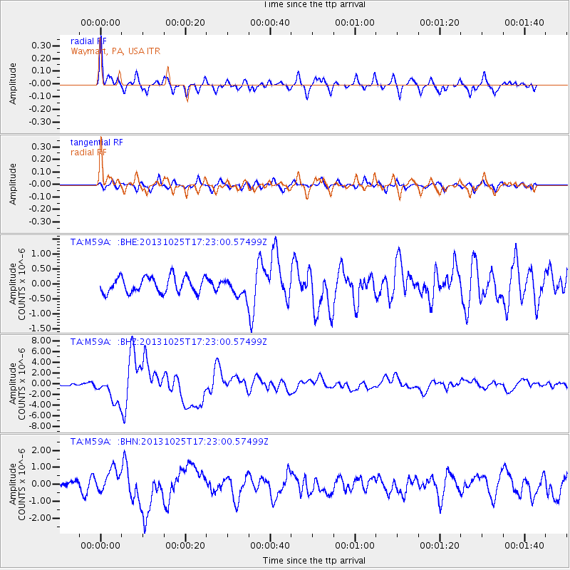
M59A Waymart, PA, USA - Earthquake Result Viewer

Earthquake location: Off East Coast Of Honshu, Japan
Earthquake latitude/longitude: 37.2/144.7
Earthquake time(UTC): 2013/10/25 (298) 17:10:19 GMT
Earthquake Depth: 35 km
Earthquake Magnitude: 7.1 MWW, 7.1 MWW, 7.1 MWB, 7.1 MWC, 7.2 MWC, 7.5 MI
Earthquake Catalog/Contributor: NEIC PDE/NEIC COMCAT
Network: TA USArray Transportable Network (new EarthScope stations)
Station: M59A Waymart, PA, USA
Lat/Lon: 41.54 N/75.43 W
Elevation: 471 m
Distance: 93.5 deg
Az: 28.972 deg
Baz: 328.968 deg
Ray Param: 0.041231614
Estimated Moho Depth: 19.75 km
Estimated Crust Vp/Vs: 1.79
Assumed Crust Vp: 6.283 km/s
Estimated Crust Vs: 3.52 km/s
Estimated Crust Poisson's Ratio: 0.27
Radial Match: 81.88201 %
Radial Bump: 400
Transverse Match: 69.85394 %
Transverse Bump: 400
SOD ConfigId: 626651
Insert Time: 2014-04-19 06:12:39.174 +0000
GWidth: 2.5
Max Bumps: 400
Tol: 0.001

Signal To Noise

ChannelStoNSTALTA
TA:M59A: :BHZ:20131025T17:23:00.57499Z5.55314732.500573E-64.5029833E-7
TA:M59A: :BHN:20131025T17:23:00.57499Z2.3606587.0591403E-72.9903276E-7
TA:M59A: :BHE:20131025T17:23:00.57499Z1.18724633.0907793E-72.6033177E-7
Arrivals
Ps2.5 SECOND
PpPs8.6 SECOND
PsPs/PpSs11 SECOND