N47A Urbana, IN, USA - Earthquake Result Viewer
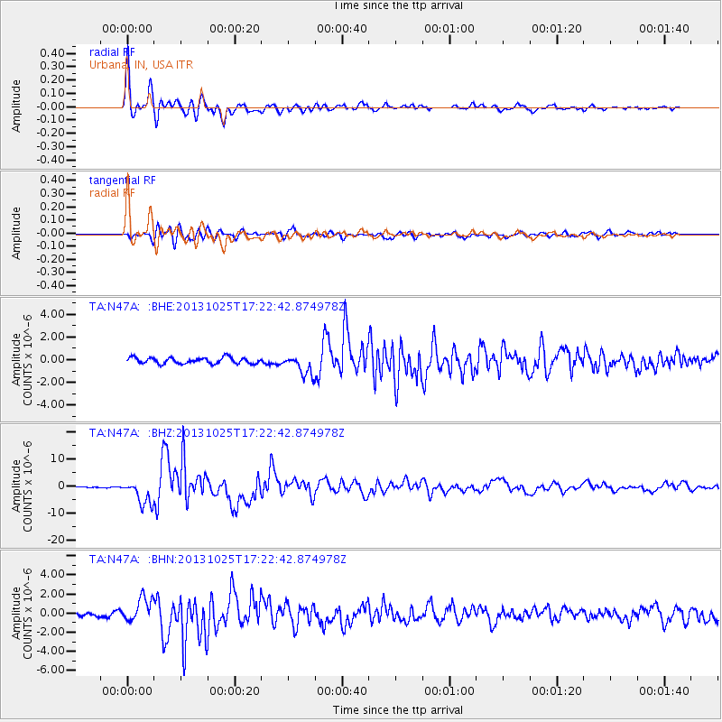
Earthquake location: Off East Coast Of Honshu, Japan
Earthquake latitude/longitude: 37.2/144.7
Earthquake time(UTC): 2013/10/25 (298) 17:10:19 GMT
Earthquake Depth: 35 km
Earthquake Magnitude: 7.1 MWW, 7.1 MWW, 7.1 MWB, 7.1 MWC, 7.2 MWC, 7.5 MI
Earthquake Catalog/Contributor: NEIC PDE/NEIC COMCAT
Network: TA USArray Transportable Network (new EarthScope stations)
Station: N47A Urbana, IN, USA
Lat/Lon: 40.88 N/85.69 W
Elevation: 252 m
Distance: 89.7 deg
Az: 35.723 deg
Baz: 322.033 deg
Ray Param: 0.04172307
Estimated Moho Depth: 32.5 km
Estimated Crust Vp/Vs: 1.83
Assumed Crust Vp: 6.498 km/s
Estimated Crust Vs: 3.551 km/s
Estimated Crust Poisson's Ratio: 0.29
Radial Match: 96.46642 %
Radial Bump: 400
Transverse Match: 80.822655 %
Transverse Bump: 400
SOD ConfigId: 626651
Insert Time: 2014-04-19 06:13:11.731 +0000
GWidth: 2.5
Max Bumps: 400
Tol: 0.001

Signal To Noise

ChannelStoNSTALTA
TA:N47A: :BHZ:20131025T17:22:42.874978Z17.9947474.5630513E-62.5357684E-7
TA:N47A: :BHN:20131025T17:22:42.874978Z5.7307871.2136862E-62.1178354E-7
TA:N47A: :BHE:20131025T17:22:42.874978Z3.44230878.979092E-72.6084507E-7
Arrivals
Ps4.2 SECOND
PpPs14 SECOND
PsPs/PpSs18 SECOND