You are here: Home > Network List > TA - USArray Transportable Network (new EarthScope stations) Stations List
> Station N62A Caumsett State Park, Huntington, NY, USA > Earthquake Result Viewer
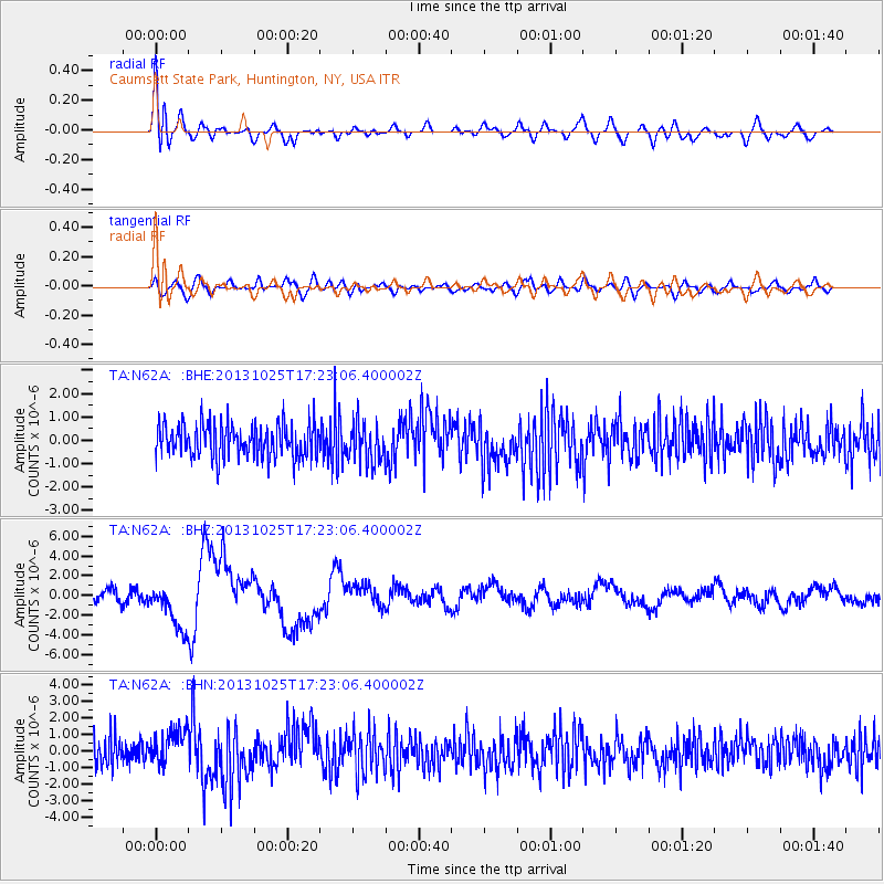
N62A Caumsett State Park, Huntington, NY, USA - Earthquake Result Viewer
*The percent match for this event was below the threshold and hence no stack was calculated.
| Earthquake location: |
Off East Coast Of Honshu, Japan |
| Earthquake latitude/longitude: |
37.2/144.7 |
| Earthquake time(UTC): |
2013/10/25 (298) 17:10:19 GMT |
| Earthquake Depth: |
35 km |
| Earthquake Magnitude: |
7.1 MWW, 7.1 MWW, 7.1 MWB, 7.1 MWC, 7.2 MWC, 7.5 MI |
| Earthquake Catalog/Contributor: |
NEIC PDE/NEIC COMCAT |
|
| Network: |
TA USArray Transportable Network (new EarthScope stations) |
| Station: |
N62A Caumsett State Park, Huntington, NY, USA |
| Lat/Lon: |
40.93 N/73.47 W |
| Elevation: |
34 m |
|
| Distance: |
94.8 deg |
| Az: |
27.999 deg |
| Baz: |
330.328 deg |
| Ray Param: |
$rayparam |
*The percent match for this event was below the threshold and hence was not used in the summary stack. |
|
| Radial Match: |
76.17292 % |
| Radial Bump: |
400 |
| Transverse Match: |
54.509556 % |
| Transverse Bump: |
400 |
| SOD ConfigId: |
626651 |
| Insert Time: |
2014-04-19 06:13:55.672 +0000 |
| GWidth: |
2.5 |
| Max Bumps: |
400 |
| Tol: |
0.001 |
|
Signal To Noise
| Channel | StoN | STA | LTA |
| TA:N62A: :BHZ:20131025T17:23:06.400002Z | 3.8042405 | 2.3855096E-6 | 6.270659E-7 |
| TA:N62A: :BHN:20131025T17:23:06.400002Z | 1.2762097 | 1.0459887E-6 | 8.196057E-7 |
| TA:N62A: :BHE:20131025T17:23:06.400002Z | 1.1744388 | 8.315662E-7 | 7.080541E-7 |
| Arrivals |
| Ps | |
| PpPs | |
| PsPs/PpSs | |


