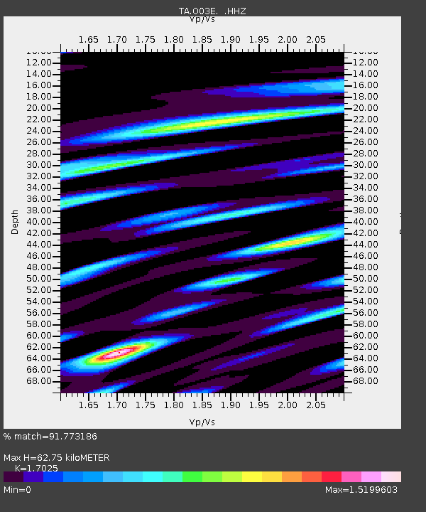
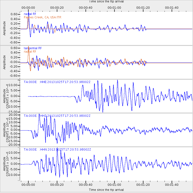
O03E Paynes Creek, CA, USA - Earthquake Result Viewer

Earthquake location: Off East Coast Of Honshu, Japan
Earthquake latitude/longitude: 37.2/144.7
Earthquake time(UTC): 2013/10/25 (298) 17:10:19 GMT
Earthquake Depth: 35 km
Earthquake Magnitude: 7.1 MWW, 7.1 MWW, 7.1 MWB, 7.1 MWC, 7.2 MWC, 7.5 MI
Earthquake Catalog/Contributor: NEIC PDE/NEIC COMCAT
Network: TA USArray Transportable Network (new EarthScope stations)
Station: O03E Paynes Creek, CA, USA
Lat/Lon: 40.29 N/121.80 W
Elevation: 967 m
Distance: 69.5 deg
Az: 54.574 deg
Baz: 301.661 deg
Ray Param: 0.05553113
Estimated Moho Depth: 62.75 km
Estimated Crust Vp/Vs: 1.70
Assumed Crust Vp: 6.566 km/s
Estimated Crust Vs: 3.857 km/s
Estimated Crust Poisson's Ratio: 0.24
Radial Match: 91.773186 %
Radial Bump: 400
Transverse Match: 92.89054 %
Transverse Bump: 400
SOD ConfigId: 626651
Insert Time: 2014-04-19 06:14:01.734 +0000
GWidth: 2.5
Max Bumps: 400
Tol: 0.001

Signal To Noise

ChannelStoNSTALTA
TA:O03E: :HHZ:20131025T17:20:53.98002Z29.1419564.2854076E-61.4705284E-7
TA:O03E: :HHN:20131025T17:20:53.98002Z7.1279791.1984014E-61.6812639E-7
TA:O03E: :HHE:20131025T17:20:53.98002Z20.9342372.263676E-61.0813272E-7
Arrivals
Ps7.0 SECOND
PpPs25 SECOND
PsPs/PpSs32 SECOND