O44A Mansfield, IL, USA - Earthquake Result Viewer
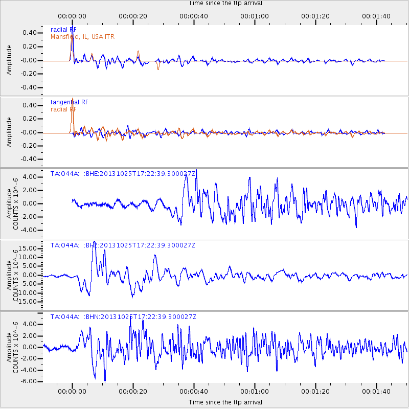
Earthquake location: Off East Coast Of Honshu, Japan
Earthquake latitude/longitude: 37.2/144.7
Earthquake time(UTC): 2013/10/25 (298) 17:10:19 GMT
Earthquake Depth: 35 km
Earthquake Magnitude: 7.1 MWW, 7.1 MWW, 7.1 MWB, 7.1 MWC, 7.2 MWC, 7.5 MI
Earthquake Catalog/Contributor: NEIC PDE/NEIC COMCAT
Network: TA USArray Transportable Network (new EarthScope stations)
Station: O44A Mansfield, IL, USA
Lat/Lon: 40.15 N/88.47 W
Elevation: 213 m
Distance: 88.9 deg
Az: 37.826 deg
Baz: 320.264 deg
Ray Param: 0.042182773
Estimated Moho Depth: 62.0 km
Estimated Crust Vp/Vs: 2.03
Assumed Crust Vp: 6.498 km/s
Estimated Crust Vs: 3.209 km/s
Estimated Crust Poisson's Ratio: 0.34
Radial Match: 93.83319 %
Radial Bump: 400
Transverse Match: 81.29194 %
Transverse Bump: 400
SOD ConfigId: 626651
Insert Time: 2014-04-19 06:14:03.609 +0000
GWidth: 2.5
Max Bumps: 400
Tol: 0.001

Signal To Noise

ChannelStoNSTALTA
TA:O44A: :BHZ:20131025T17:22:39.300027Z16.2351284.311814E-62.6558544E-7
TA:O44A: :BHN:20131025T17:22:39.300027Z4.14161731.2802886E-63.091277E-7
TA:O44A: :BHE:20131025T17:22:39.300027Z3.42406941.080141E-63.1545534E-7
Arrivals
Ps10.0 SECOND
PpPs28 SECOND
PsPs/PpSs38 SECOND