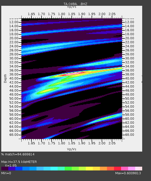
O49A Covington, OH, USA - Earthquake Result Viewer

Earthquake location: Off East Coast Of Honshu, Japan
Earthquake latitude/longitude: 37.2/144.7
Earthquake time(UTC): 2013/10/25 (298) 17:10:19 GMT
Earthquake Depth: 35 km
Earthquake Magnitude: 7.1 MWW, 7.1 MWW, 7.1 MWB, 7.1 MWC, 7.2 MWC, 7.5 MI
Earthquake Catalog/Contributor: NEIC PDE/NEIC COMCAT
Network: TA USArray Transportable Network (new EarthScope stations)
Station: O49A Covington, OH, USA
Lat/Lon: 40.19 N/84.34 W
Elevation: 292 m
Distance: 90.9 deg
Az: 35.323 deg
Baz: 322.915 deg
Ray Param: 0.041638974
Estimated Moho Depth: 37.5 km
Estimated Crust Vp/Vs: 1.85
Assumed Crust Vp: 6.498 km/s
Estimated Crust Vs: 3.512 km/s
Estimated Crust Poisson's Ratio: 0.29
Radial Match: 94.688614 %
Radial Bump: 367
Transverse Match: 86.21619 %
Transverse Bump: 400
SOD ConfigId: 626651
Insert Time: 2014-04-19 06:14:07.075 +0000
GWidth: 2.5
Max Bumps: 400
Tol: 0.001

Signal To Noise

ChannelStoNSTALTA
TA:O49A: :BHZ:20131025T17:22:48.324014Z11.4773873.433581E-62.991605E-7
TA:O49A: :BHN:20131025T17:22:48.324014Z2.0836687.302404E-73.504591E-7
TA:O49A: :BHE:20131025T17:22:48.324014Z3.87394577.4312766E-71.9182707E-7
Arrivals
Ps5.0 SECOND
PpPs16 SECOND
PsPs/PpSs21 SECOND