
O50A Cable, OH, USA - Earthquake Result Viewer
| ||||||||||||||||||
| ||||||||||||||||||
| ||||||||||||||||||
|
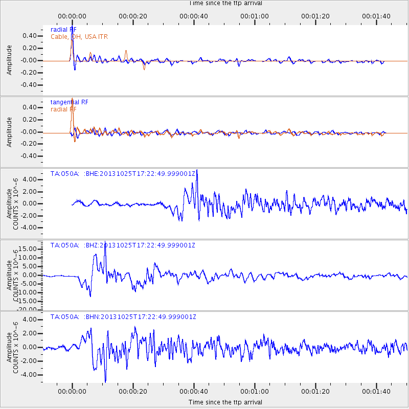
Signal To Noise
| Channel | StoN | STA | LTA |
| TA:O50A: :BHZ:20131025T17:22:49.999001Z | 12.267397 | 3.1127822E-6 | 2.537443E-7 |
| TA:O50A: :BHN:20131025T17:22:49.999001Z | 4.988235 | 8.757679E-7 | 1.755667E-7 |
| TA:O50A: :BHE:20131025T17:22:49.999001Z | 3.3782399 | 8.34251E-7 | 2.4694842E-7 |
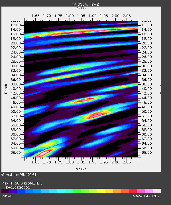
| Arrivals | |
| Ps | 7.3 SECOND |
| PpPs | 27 SECOND |
| PsPs/PpSs | 35 SECOND |

