
O52A Adamsville, OH, USA - Earthquake Result Viewer
| ||||||||||||||||||
| ||||||||||||||||||
| ||||||||||||||||||
|
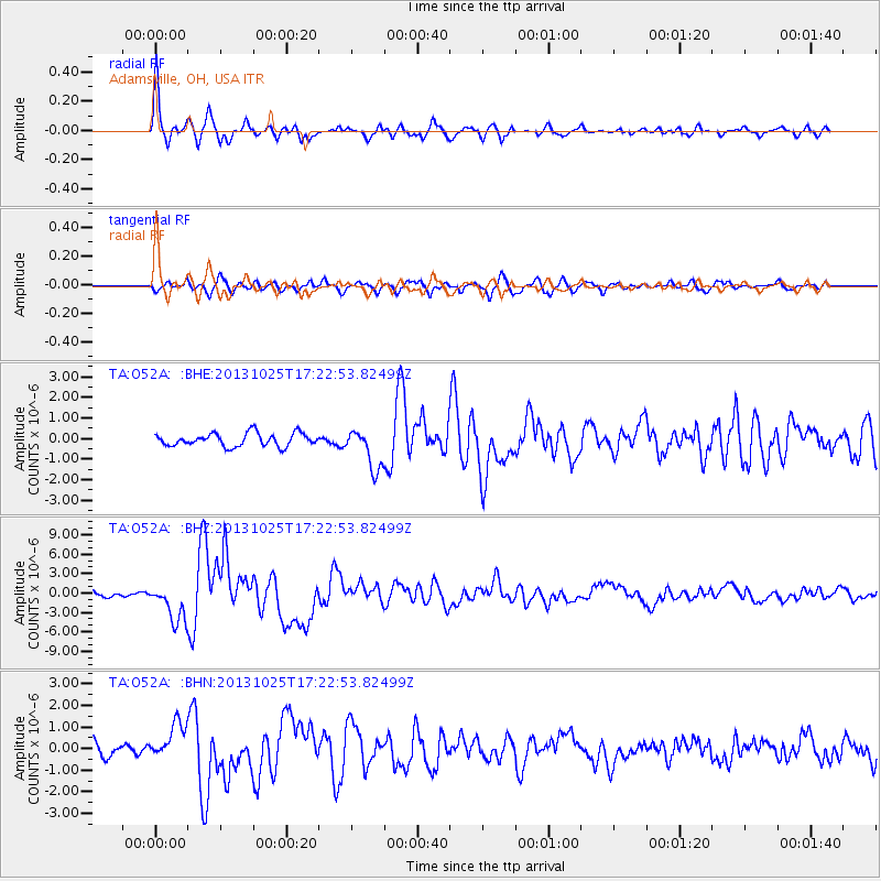
Signal To Noise
| Channel | StoN | STA | LTA |
| TA:O52A: :BHZ:20131025T17:22:53.82499Z | 5.7436805 | 2.9216649E-6 | 5.0867465E-7 |
| TA:O52A: :BHN:20131025T17:22:53.82499Z | 3.152424 | 8.451976E-7 | 2.6811037E-7 |
| TA:O52A: :BHE:20131025T17:22:53.82499Z | 3.1197844 | 9.86911E-7 | 3.1633948E-7 |
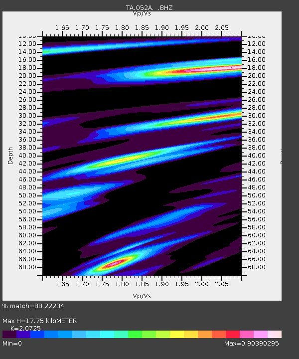
| Arrivals | |
| Ps | 3.0 SECOND |
| PpPs | 8.3 SECOND |
| PsPs/PpSs | 11 SECOND |

