O56A Blue Knob State Park, Imler, PA, USA - Earthquake Result Viewer
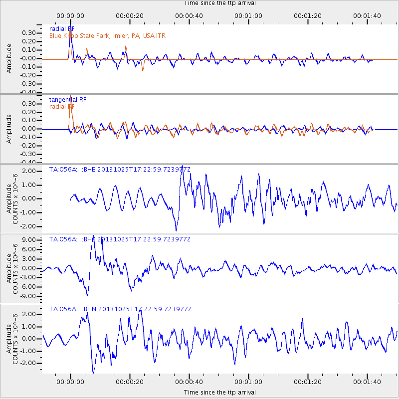
Earthquake location: Off East Coast Of Honshu, Japan
Earthquake latitude/longitude: 37.2/144.7
Earthquake time(UTC): 2013/10/25 (298) 17:10:19 GMT
Earthquake Depth: 35 km
Earthquake Magnitude: 7.1 MWW, 7.1 MWW, 7.1 MWB, 7.1 MWC, 7.2 MWC, 7.5 MI
Earthquake Catalog/Contributor: NEIC PDE/NEIC COMCAT
Network: TA USArray Transportable Network (new EarthScope stations)
Station: O56A Blue Knob State Park, Imler, PA, USA
Lat/Lon: 40.27 N/78.57 W
Elevation: 684 m
Distance: 93.3 deg
Az: 31.665 deg
Baz: 326.762 deg
Ray Param: 0.041268595
Estimated Moho Depth: 15.75 km
Estimated Crust Vp/Vs: 1.88
Assumed Crust Vp: 6.121 km/s
Estimated Crust Vs: 3.26 km/s
Estimated Crust Poisson's Ratio: 0.30
Radial Match: 93.88515 %
Radial Bump: 400
Transverse Match: 74.77046 %
Transverse Bump: 400
SOD ConfigId: 626651
Insert Time: 2014-04-19 06:14:23.729 +0000
GWidth: 2.5
Max Bumps: 400
Tol: 0.001

Signal To Noise

ChannelStoNSTALTA
TA:O56A: :BHZ:20131025T17:22:59.723977Z7.44039542.6352154E-63.541768E-7
TA:O56A: :BHN:20131025T17:22:59.723977Z3.63304289.3125465E-72.5632912E-7
TA:O56A: :BHE:20131025T17:22:59.723977Z1.21232015.5075594E-74.542991E-7
Arrivals
Ps2.3 SECOND
PpPs7.3 SECOND
PsPs/PpSs9.6 SECOND