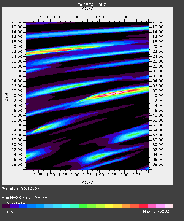
O57A Amberson, PA, USA - Earthquake Result Viewer
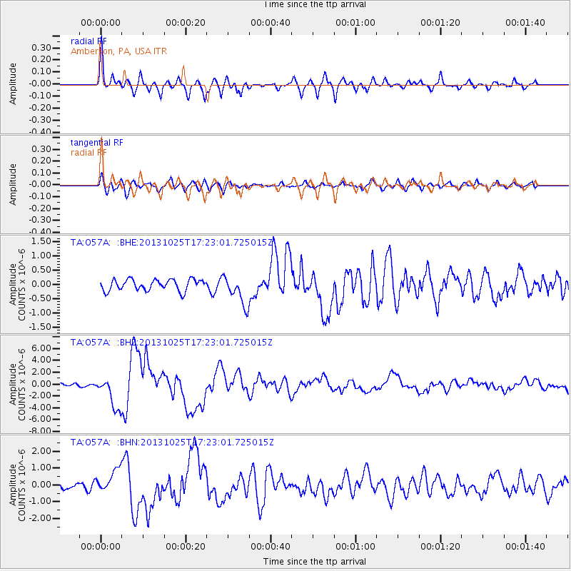
Earthquake location: Off East Coast Of Honshu, Japan
Earthquake latitude/longitude: 37.2/144.7
Earthquake time(UTC): 2013/10/25 (298) 17:10:19 GMT
Earthquake Depth: 35 km
Earthquake Magnitude: 7.1 MWW, 7.1 MWW, 7.1 MWB, 7.1 MWC, 7.2 MWC, 7.5 MI
Earthquake Catalog/Contributor: NEIC PDE/NEIC COMCAT
Network: TA USArray Transportable Network (new EarthScope stations)
Station: O57A Amberson, PA, USA
Lat/Lon: 40.21 N/77.64 W
Elevation: 377 m
Distance: 93.8 deg
Az: 31.097 deg
Baz: 327.396 deg
Ray Param: 0.041182432
Estimated Moho Depth: 38.75 km
Estimated Crust Vp/Vs: 1.96
Assumed Crust Vp: 6.121 km/s
Estimated Crust Vs: 3.119 km/s
Estimated Crust Poisson's Ratio: 0.32
Radial Match: 90.12807 %
Radial Bump: 400
Transverse Match: 75.20642 %
Transverse Bump: 400
SOD ConfigId: 626651
Insert Time: 2014-04-19 06:14:27.677 +0000
GWidth: 2.5
Max Bumps: 400
Tol: 0.001

Signal To Noise

ChannelStoNSTALTA
TA:O57A: :BHZ:20131025T17:23:01.725015Z8.5800262.802664E-63.2664985E-7
TA:O57A: :BHN:20131025T17:23:01.725015Z2.22452267.063947E-73.175489E-7
TA:O57A: :BHE:20131025T17:23:01.725015Z2.74365975.329525E-71.9424878E-7
Arrivals
Ps6.2 SECOND
PpPs18 SECOND
PsPs/PpSs25 SECOND