P55A Reedsville, WV, USA - Earthquake Result Viewer
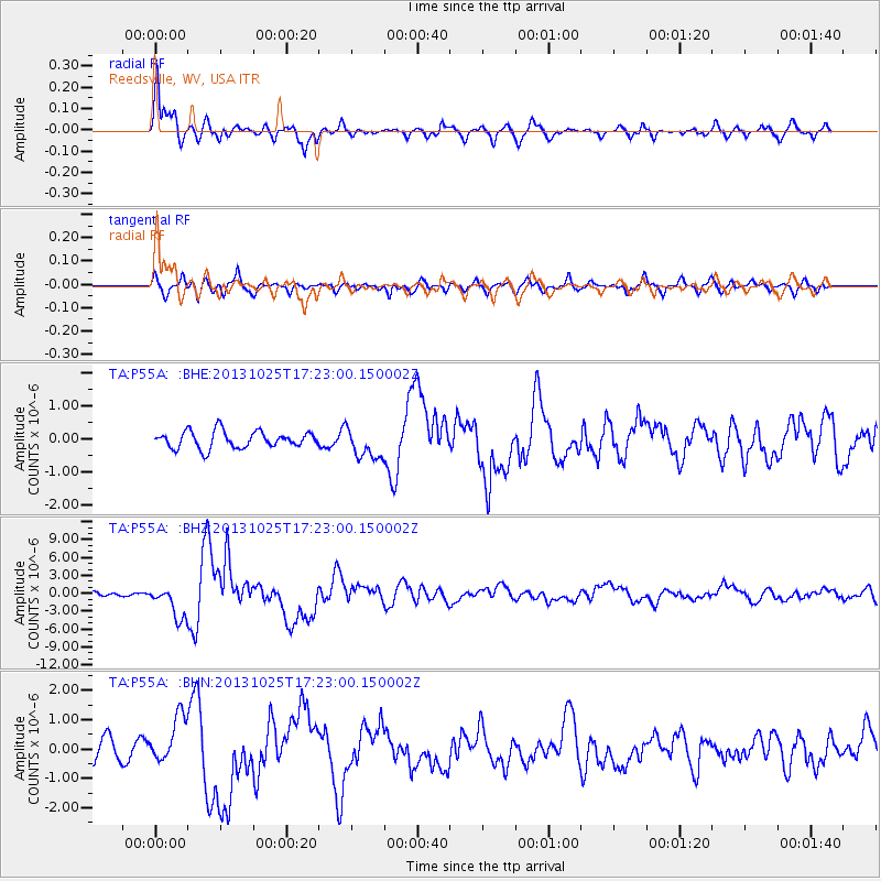
Earthquake location: Off East Coast Of Honshu, Japan
Earthquake latitude/longitude: 37.2/144.7
Earthquake time(UTC): 2013/10/25 (298) 17:10:19 GMT
Earthquake Depth: 35 km
Earthquake Magnitude: 7.1 MWW, 7.1 MWW, 7.1 MWB, 7.1 MWC, 7.2 MWC, 7.5 MI
Earthquake Catalog/Contributor: NEIC PDE/NEIC COMCAT
Network: TA USArray Transportable Network (new EarthScope stations)
Station: P55A Reedsville, WV, USA
Lat/Lon: 39.51 N/79.83 W
Elevation: 551 m
Distance: 93.4 deg
Az: 32.895 deg
Baz: 325.884 deg
Ray Param: 0.04124993
Estimated Moho Depth: 18.25 km
Estimated Crust Vp/Vs: 1.71
Assumed Crust Vp: 6.159 km/s
Estimated Crust Vs: 3.612 km/s
Estimated Crust Poisson's Ratio: 0.24
Radial Match: 89.89111 %
Radial Bump: 400
Transverse Match: 71.81103 %
Transverse Bump: 400
SOD ConfigId: 626651
Insert Time: 2014-04-19 06:15:05.422 +0000
GWidth: 2.5
Max Bumps: 400
Tol: 0.001

Signal To Noise

ChannelStoNSTALTA
TA:P55A: :BHZ:20131025T17:23:00.150002Z5.67653662.7087895E-64.771905E-7
TA:P55A: :BHN:20131025T17:23:00.150002Z1.8742697.9446926E-74.238822E-7
TA:P55A: :BHE:20131025T17:23:00.150002Z1.83070294.6319715E-72.5301603E-7
Arrivals
Ps2.1 SECOND
PpPs7.9 SECOND
PsPs/PpSs10.0 SECOND