P59A Jarrettsville, MD, USA - Earthquake Result Viewer
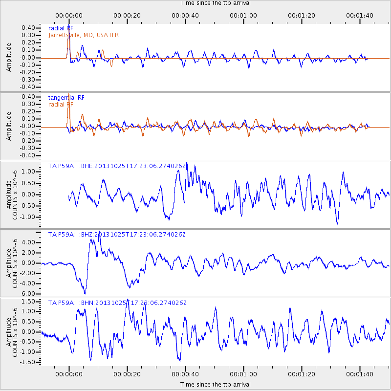
Earthquake location: Off East Coast Of Honshu, Japan
Earthquake latitude/longitude: 37.2/144.7
Earthquake time(UTC): 2013/10/25 (298) 17:10:19 GMT
Earthquake Depth: 35 km
Earthquake Magnitude: 7.1 MWW, 7.1 MWW, 7.1 MWB, 7.1 MWC, 7.2 MWC, 7.5 MI
Earthquake Catalog/Contributor: NEIC PDE/NEIC COMCAT
Network: TA USArray Transportable Network (new EarthScope stations)
Station: P59A Jarrettsville, MD, USA
Lat/Lon: 39.61 N/76.43 W
Elevation: 157 m
Distance: 94.8 deg
Az: 30.632 deg
Baz: 328.199 deg
Ray Param: 0.040942784
Estimated Moho Depth: 62.5 km
Estimated Crust Vp/Vs: 2.05
Assumed Crust Vp: 6.419 km/s
Estimated Crust Vs: 3.139 km/s
Estimated Crust Poisson's Ratio: 0.34
Radial Match: 80.16922 %
Radial Bump: 400
Transverse Match: 55.689625 %
Transverse Bump: 400
SOD ConfigId: 626651
Insert Time: 2014-04-19 06:15:16.552 +0000
GWidth: 2.5
Max Bumps: 400
Tol: 0.001

Signal To Noise

ChannelStoNSTALTA
TA:P59A: :BHZ:20131025T17:23:06.274026Z10.3893352.3748169E-62.2858218E-7
TA:P59A: :BHN:20131025T17:23:06.274026Z3.08654987.811443E-72.530801E-7
TA:P59A: :BHE:20131025T17:23:06.274026Z1.95317295.8737857E-73.0073045E-7
Arrivals
Ps10 SECOND
PpPs29 SECOND
PsPs/PpSs39 SECOND