Q51A Peebles, OH, USA - Earthquake Result Viewer
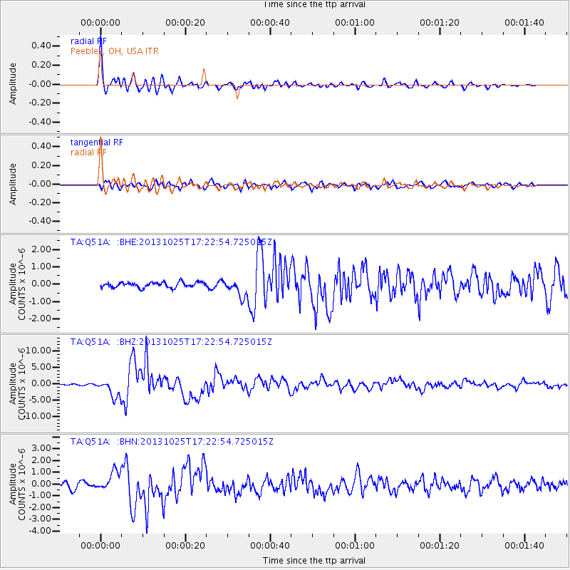
Earthquake location: Off East Coast Of Honshu, Japan
Earthquake latitude/longitude: 37.2/144.7
Earthquake time(UTC): 2013/10/25 (298) 17:10:19 GMT
Earthquake Depth: 35 km
Earthquake Magnitude: 7.1 MWW, 7.1 MWW, 7.1 MWB, 7.1 MWC, 7.2 MWC, 7.5 MI
Earthquake Catalog/Contributor: NEIC PDE/NEIC COMCAT
Network: TA USArray Transportable Network (new EarthScope stations)
Station: Q51A Peebles, OH, USA
Lat/Lon: 39.03 N/83.35 W
Elevation: 362 m
Distance: 92.2 deg
Az: 35.405 deg
Baz: 323.541 deg
Ray Param: 0.041477975
Estimated Moho Depth: 26.75 km
Estimated Crust Vp/Vs: 1.99
Assumed Crust Vp: 6.232 km/s
Estimated Crust Vs: 3.131 km/s
Estimated Crust Poisson's Ratio: 0.33
Radial Match: 92.46159 %
Radial Bump: 400
Transverse Match: 83.19408 %
Transverse Bump: 400
SOD ConfigId: 626651
Insert Time: 2014-04-19 06:15:37.638 +0000
GWidth: 2.5
Max Bumps: 400
Tol: 0.001

Signal To Noise

ChannelStoNSTALTA
TA:Q51A: :BHZ:20131025T17:22:54.725015Z10.3828912.8477757E-62.742758E-7
TA:Q51A: :BHN:20131025T17:22:54.725015Z2.854758.757754E-73.0677833E-7
TA:Q51A: :BHE:20131025T17:22:54.725015Z3.55084515.230343E-71.4729854E-7
Arrivals
Ps4.3 SECOND
PpPs13 SECOND
PsPs/PpSs17 SECOND