Q56A Snyder Ridge, Maysville, WV, USA - Earthquake Result Viewer
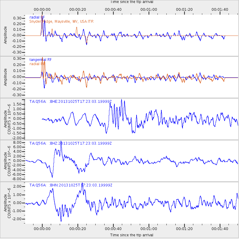
Earthquake location: Off East Coast Of Honshu, Japan
Earthquake latitude/longitude: 37.2/144.7
Earthquake time(UTC): 2013/10/25 (298) 17:10:19 GMT
Earthquake Depth: 35 km
Earthquake Magnitude: 7.1 MWW, 7.1 MWW, 7.1 MWB, 7.1 MWC, 7.2 MWC, 7.5 MI
Earthquake Catalog/Contributor: NEIC PDE/NEIC COMCAT
Network: TA USArray Transportable Network (new EarthScope stations)
Station: Q56A Snyder Ridge, Maysville, WV, USA
Lat/Lon: 39.04 N/79.19 W
Elevation: 430 m
Distance: 94.1 deg
Az: 32.743 deg
Baz: 326.297 deg
Ray Param: 0.041109495
Estimated Moho Depth: 12.0 km
Estimated Crust Vp/Vs: 1.69
Assumed Crust Vp: 6.159 km/s
Estimated Crust Vs: 3.65 km/s
Estimated Crust Poisson's Ratio: 0.23
Radial Match: 91.77112 %
Radial Bump: 400
Transverse Match: 69.27829 %
Transverse Bump: 400
SOD ConfigId: 626651
Insert Time: 2014-04-19 06:15:48.491 +0000
GWidth: 2.5
Max Bumps: 400
Tol: 0.001

Signal To Noise

ChannelStoNSTALTA
TA:Q56A: :BHZ:20131025T17:23:03.19999Z6.91965771.996002E-62.8845386E-7
TA:Q56A: :BHN:20131025T17:23:03.19999Z3.60056737.386249E-72.0514125E-7
TA:Q56A: :BHE:20131025T17:23:03.19999Z1.4429924.498856E-73.1177274E-7
Arrivals
Ps1.4 SECOND
PpPs5.1 SECOND
PsPs/PpSs6.5 SECOND