R11A Troy Canyon, Currant, NV, USA - Earthquake Result Viewer
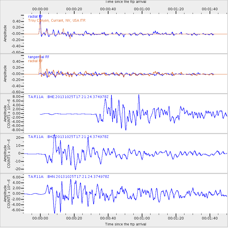
Earthquake location: Off East Coast Of Honshu, Japan
Earthquake latitude/longitude: 37.2/144.7
Earthquake time(UTC): 2013/10/25 (298) 17:10:19 GMT
Earthquake Depth: 35 km
Earthquake Magnitude: 7.1 MWW, 7.1 MWW, 7.1 MWB, 7.1 MWC, 7.2 MWC, 7.5 MI
Earthquake Catalog/Contributor: NEIC PDE/NEIC COMCAT
Network: TA USArray Transportable Network (new EarthScope stations)
Station: R11A Troy Canyon, Currant, NV, USA
Lat/Lon: 38.35 N/115.59 W
Elevation: 1756 m
Distance: 74.6 deg
Az: 53.483 deg
Baz: 305.251 deg
Ray Param: 0.05215722
Estimated Moho Depth: 30.5 km
Estimated Crust Vp/Vs: 1.81
Assumed Crust Vp: 6.276 km/s
Estimated Crust Vs: 3.467 km/s
Estimated Crust Poisson's Ratio: 0.28
Radial Match: 97.67373 %
Radial Bump: 400
Transverse Match: 92.1927 %
Transverse Bump: 400
SOD ConfigId: 626651
Insert Time: 2014-04-19 06:16:04.757 +0000
GWidth: 2.5
Max Bumps: 400
Tol: 0.001

Signal To Noise

ChannelStoNSTALTA
TA:R11A: :BHZ:20131025T17:21:24.374978Z39.573524.516587E-61.14131545E-7
TA:R11A: :BHN:20131025T17:21:24.374978Z11.2360931.2745802E-61.1343624E-7
TA:R11A: :BHE:20131025T17:21:24.374978Z12.2240341.5366463E-61.2570698E-7
Arrivals
Ps4.1 SECOND
PpPs13 SECOND
PsPs/PpSs17 SECOND