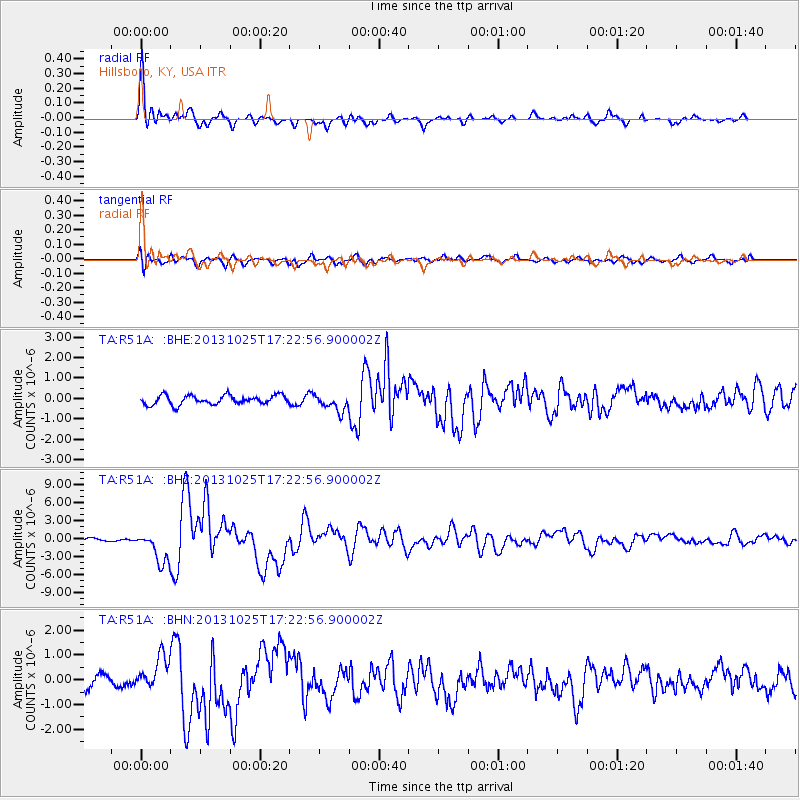
R51A Hillsboro, KY, USA - Earthquake Result Viewer
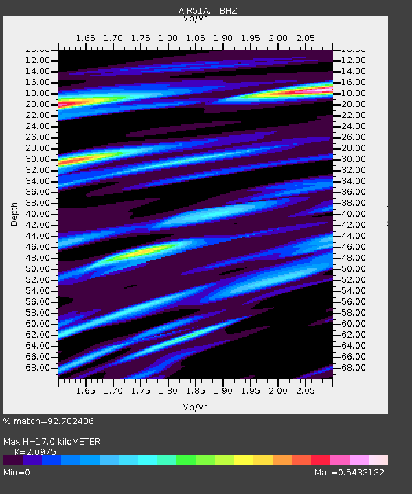
Earthquake location: Off East Coast Of Honshu, Japan
Earthquake latitude/longitude: 37.2/144.7
Earthquake time(UTC): 2013/10/25 (298) 17:10:19 GMT
Earthquake Depth: 35 km
Earthquake Magnitude: 7.1 MWW, 7.1 MWW, 7.1 MWB, 7.1 MWC, 7.2 MWC, 7.5 MI
Earthquake Catalog/Contributor: NEIC PDE/NEIC COMCAT
Network: TA USArray Transportable Network (new EarthScope stations)
Station: R51A Hillsboro, KY, USA
Lat/Lon: 38.30 N/83.58 W
Elevation: 231 m
Distance: 92.7 deg
Az: 35.987 deg
Baz: 323.368 deg
Ray Param: 0.041391116
Estimated Moho Depth: 17.0 km
Estimated Crust Vp/Vs: 2.10
Assumed Crust Vp: 6.232 km/s
Estimated Crust Vs: 2.971 km/s
Estimated Crust Poisson's Ratio: 0.35
Radial Match: 92.782486 %
Radial Bump: 400
Transverse Match: 73.46669 %
Transverse Bump: 400
SOD ConfigId: 626651
Insert Time: 2014-04-19 06:16:14.950 +0000
GWidth: 2.5
Max Bumps: 400
Tol: 0.001

Signal To Noise

ChannelStoNSTALTA
TA:R51A: :BHZ:20131025T17:22:56.900002Z14.4366692.633166E-61.823943E-7
TA:R51A: :BHN:20131025T17:22:56.900002Z2.07374296.367098E-73.070341E-7
TA:R51A: :BHE:20131025T17:22:56.900002Z1.86547024.149897E-72.2245851E-7
Arrivals
Ps3.0 SECOND
PpPs8.3 SECOND
PsPs/PpSs11 SECOND