R53A Hurricane, WV, USA - Earthquake Result Viewer
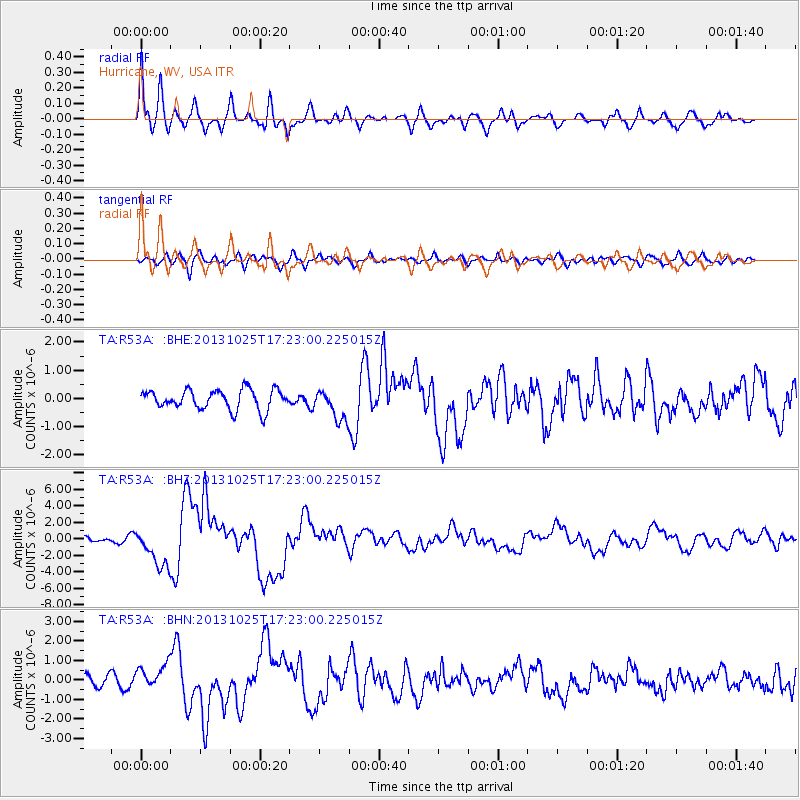
Earthquake location: Off East Coast Of Honshu, Japan
Earthquake latitude/longitude: 37.2/144.7
Earthquake time(UTC): 2013/10/25 (298) 17:10:19 GMT
Earthquake Depth: 35 km
Earthquake Magnitude: 7.1 MWW, 7.1 MWW, 7.1 MWB, 7.1 MWC, 7.2 MWC, 7.5 MI
Earthquake Catalog/Contributor: NEIC PDE/NEIC COMCAT
Network: TA USArray Transportable Network (new EarthScope stations)
Station: R53A Hurricane, WV, USA
Lat/Lon: 38.33 N/81.95 W
Elevation: 294 m
Distance: 93.5 deg
Az: 34.93 deg
Baz: 324.432 deg
Ray Param: 0.041246448
Estimated Moho Depth: 18.5 km
Estimated Crust Vp/Vs: 2.09
Assumed Crust Vp: 6.207 km/s
Estimated Crust Vs: 2.97 km/s
Estimated Crust Poisson's Ratio: 0.35
Radial Match: 87.95644 %
Radial Bump: 400
Transverse Match: 62.317085 %
Transverse Bump: 400
SOD ConfigId: 626651
Insert Time: 2014-04-19 06:16:21.696 +0000
GWidth: 2.5
Max Bumps: 400
Tol: 0.001

Signal To Noise

ChannelStoNSTALTA
TA:R53A: :BHZ:20131025T17:23:00.225015Z11.8796562.4217659E-62.0385825E-7
TA:R53A: :BHN:20131025T17:23:00.225015Z2.67367276.383222E-72.3874358E-7
TA:R53A: :BHE:20131025T17:23:00.225015Z1.57979045.453102E-73.4517882E-7
Arrivals
Ps3.3 SECOND
PpPs9.1 SECOND
PsPs/PpSs12 SECOND