
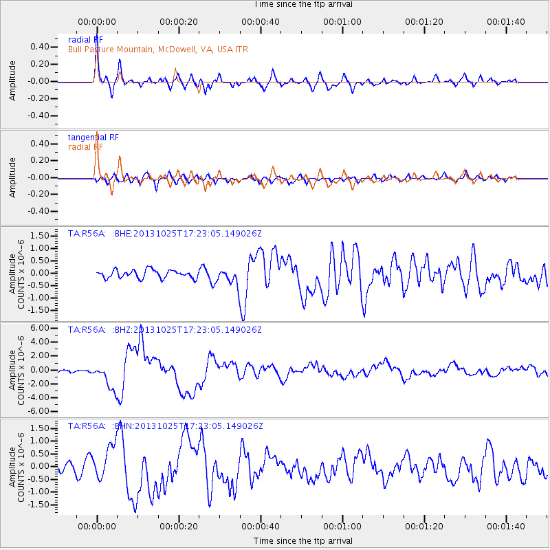
R56A Bull Pasture Mountain, McDowell, VA, USA - Earthquake Result Viewer
| ||||||||||||||||||
| ||||||||||||||||||
| ||||||||||||||||||
|
Signal To Noise
| Channel | StoN | STA | LTA |
| TA:R56A: :BHZ:20131025T17:23:05.149026Z | 10.639366 | 1.9392899E-6 | 1.8227495E-7 |
| TA:R56A: :BHN:20131025T17:23:05.149026Z | 3.033619 | 6.85356E-7 | 2.2592027E-7 |
| TA:R56A: :BHE:20131025T17:23:05.149026Z | 2.1982229 | 3.5512545E-7 | 1.6155116E-7 |
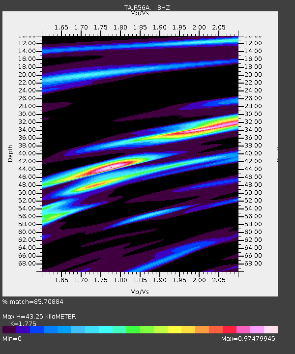
| Arrivals | |
| Ps | 5.5 SECOND |
| PpPs | 19 SECOND |
| PsPs/PpSs | 25 SECOND |

