
S49A Springfield, KY, USA - Earthquake Result Viewer
| ||||||||||||||||||
| ||||||||||||||||||
| ||||||||||||||||||
|
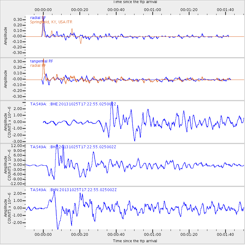
Signal To Noise
| Channel | StoN | STA | LTA |
| TA:S49A: :BHZ:20131025T17:22:55.025002Z | 9.888661 | 2.997519E-6 | 3.0312688E-7 |
| TA:S49A: :BHN:20131025T17:22:55.025002Z | 3.5318475 | 6.446254E-7 | 1.8251791E-7 |
| TA:S49A: :BHE:20131025T17:22:55.025002Z | 3.3321211 | 6.315035E-7 | 1.8951998E-7 |
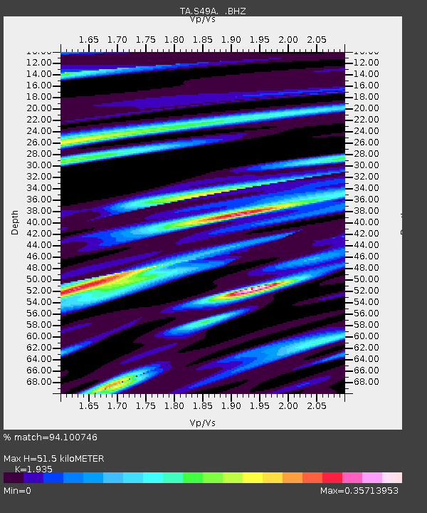
| Arrivals | |
| Ps | 7.6 SECOND |
| PpPs | 23 SECOND |
| PsPs/PpSs | 30 SECOND |

