S50A Richmond, KY, USA - Earthquake Result Viewer
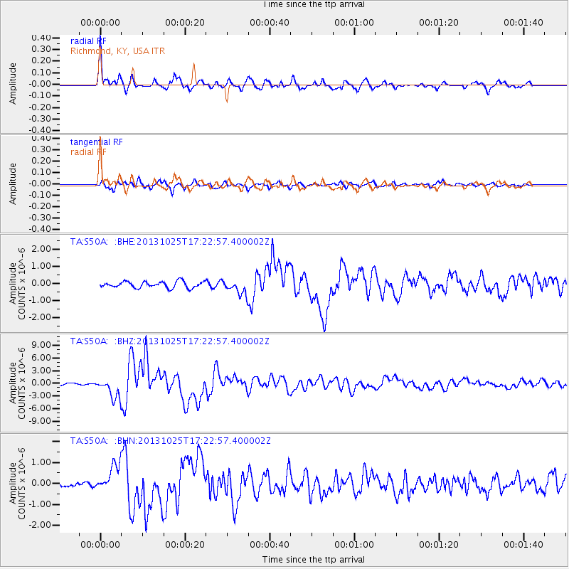
Earthquake location: Off East Coast Of Honshu, Japan
Earthquake latitude/longitude: 37.2/144.7
Earthquake time(UTC): 2013/10/25 (298) 17:10:19 GMT
Earthquake Depth: 35 km
Earthquake Magnitude: 7.1 MWW, 7.1 MWW, 7.1 MWB, 7.1 MWC, 7.2 MWC, 7.5 MI
Earthquake Catalog/Contributor: NEIC PDE/NEIC COMCAT
Network: TA USArray Transportable Network (new EarthScope stations)
Station: S50A Richmond, KY, USA
Lat/Lon: 37.68 N/84.40 W
Elevation: 300 m
Distance: 92.8 deg
Az: 36.877 deg
Baz: 322.824 deg
Ray Param: 0.041369718
Estimated Moho Depth: 10.0 km
Estimated Crust Vp/Vs: 2.06
Assumed Crust Vp: 6.476 km/s
Estimated Crust Vs: 3.147 km/s
Estimated Crust Poisson's Ratio: 0.35
Radial Match: 94.528336 %
Radial Bump: 400
Transverse Match: 88.5438 %
Transverse Bump: 400
SOD ConfigId: 626651
Insert Time: 2014-04-19 06:16:49.947 +0000
GWidth: 2.5
Max Bumps: 400
Tol: 0.001

Signal To Noise

ChannelStoNSTALTA
TA:S50A: :BHZ:20131025T17:22:57.400002Z14.7788712.44432E-61.6539289E-7
TA:S50A: :BHN:20131025T17:22:57.400002Z4.2825926.6504106E-71.552894E-7
TA:S50A: :BHE:20131025T17:22:57.400002Z2.39217664.364858E-71.8246386E-7
Arrivals
Ps1.7 SECOND
PpPs4.6 SECOND
PsPs/PpSs6.3 SECOND