
S52A Salyersville, KY, USA - Earthquake Result Viewer
| ||||||||||||||||||
| ||||||||||||||||||
| ||||||||||||||||||
|
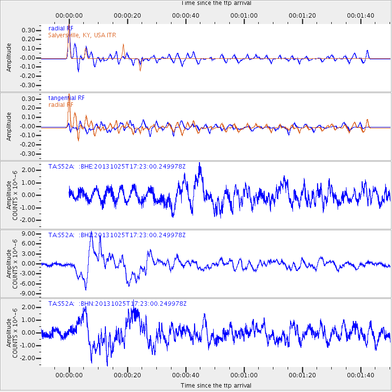
Signal To Noise
| Channel | StoN | STA | LTA |
| TA:S52A: :BHZ:20131025T17:23:00.249978Z | 4.6179514 | 2.3764385E-6 | 5.146088E-7 |
| TA:S52A: :BHN:20131025T17:23:00.249978Z | 2.5260298 | 7.8015955E-7 | 3.0884814E-7 |
| TA:S52A: :BHE:20131025T17:23:00.249978Z | 1.1924123 | 5.240101E-7 | 4.3945383E-7 |
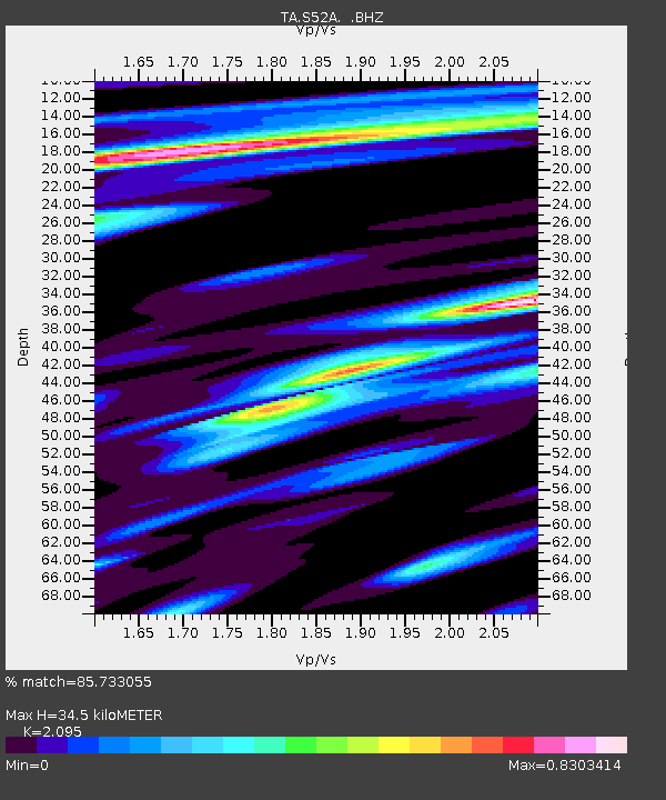
| Arrivals | |
| Ps | 5.9 SECOND |
| PpPs | 16 SECOND |
| PsPs/PpSs | 22 SECOND |

