
S57A Dark Hollow, Roseland, VA, USA - Earthquake Result Viewer
| ||||||||||||||||||
| ||||||||||||||||||
| ||||||||||||||||||
|
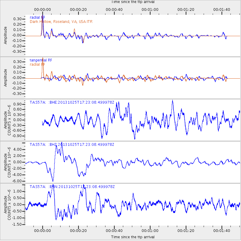
Signal To Noise
| Channel | StoN | STA | LTA |
| TA:S57A: :BHZ:20131025T17:23:08.499978Z | 7.483129 | 1.7706462E-6 | 2.3661842E-7 |
| TA:S57A: :BHN:20131025T17:23:08.499978Z | 2.9918435 | 5.0346307E-7 | 1.6827855E-7 |
| TA:S57A: :BHE:20131025T17:23:08.499978Z | 2.1674335 | 4.6300357E-7 | 2.1361836E-7 |
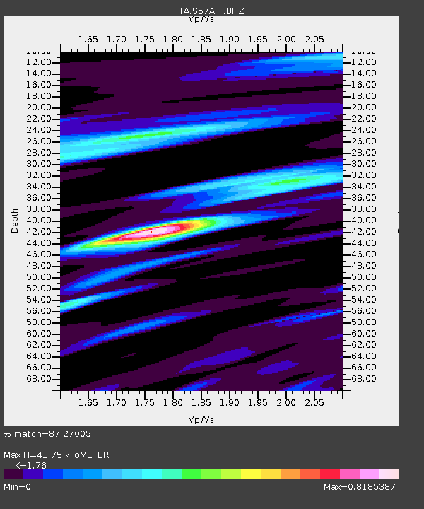
| Arrivals | |
| Ps | 5.0 SECOND |
| PpPs | 18 SECOND |
| PsPs/PpSs | 23 SECOND |

