
T56A Rocky Mt, VA, USA - Earthquake Result Viewer
| ||||||||||||||||||
| ||||||||||||||||||
| ||||||||||||||||||
|
Signal To Noise
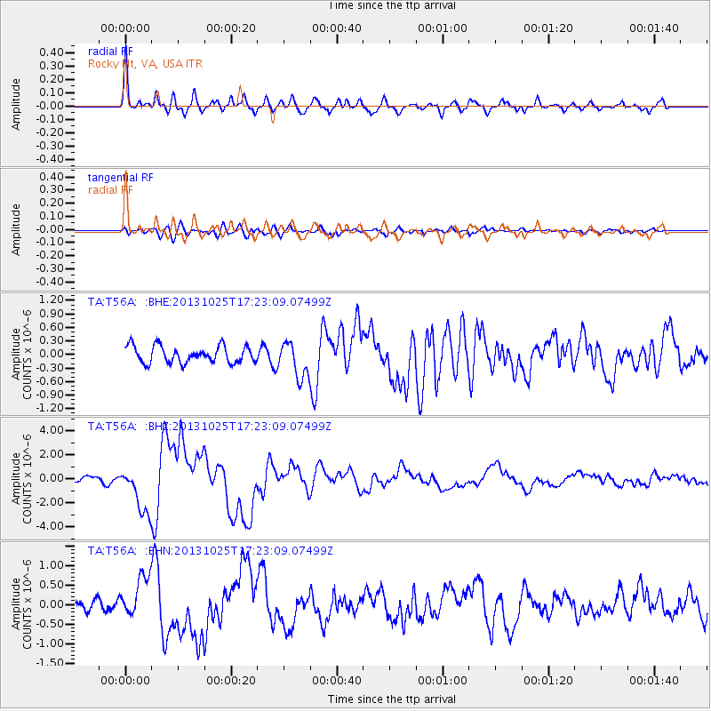
| Channel | StoN | STA | LTA |
| TA:T56A: :BHZ:20131025T17:23:09.07499Z | 11.861564 | 1.9741647E-6 | 1.6643375E-7 |
| TA:T56A: :BHN:20131025T17:23:09.07499Z | 4.236073 | 5.37432E-7 | 1.2687033E-7 |
| TA:T56A: :BHE:20131025T17:23:09.07499Z | 2.1138198 | 3.9332983E-7 | 1.8607538E-7 |
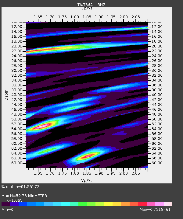
| Arrivals | |
| Ps | 5.8 SECOND |
| PpPs | 22 SECOND |
| PsPs/PpSs | 28 SECOND |

