
T57A Hurt, VA, USA - Earthquake Result Viewer
| ||||||||||||||||||
| ||||||||||||||||||
| ||||||||||||||||||
|
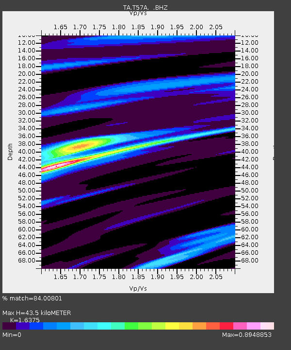
Signal To Noise
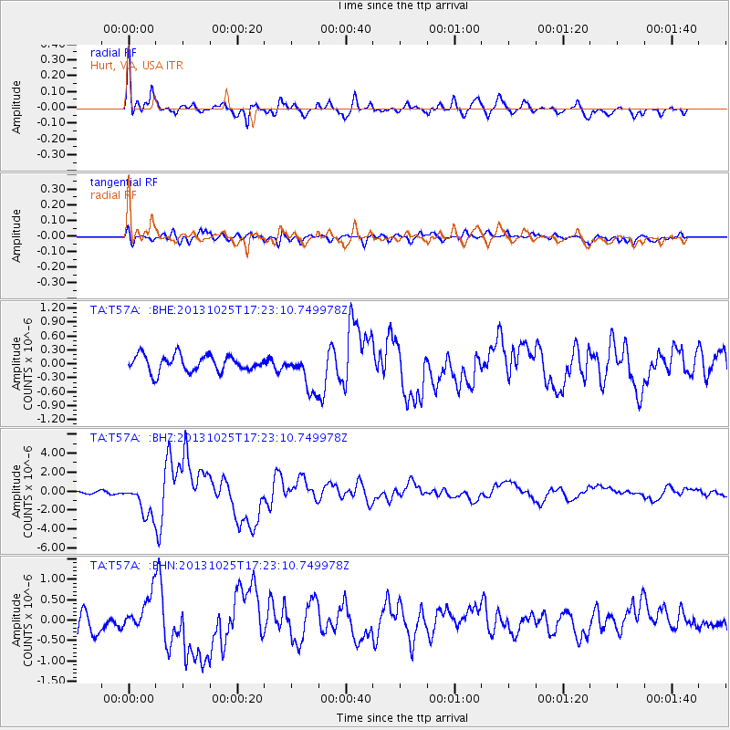
| Channel | StoN | STA | LTA |
| TA:T57A: :BHZ:20131025T17:23:10.749978Z | 9.107372 | 1.7822459E-6 | 1.9569265E-7 |
| TA:T57A: :BHN:20131025T17:23:10.749978Z | 1.3202161 | 3.7451474E-7 | 2.8367685E-7 |
| TA:T57A: :BHE:20131025T17:23:10.749978Z | 2.3931477 | 4.1570584E-7 | 1.7370674E-7 |
| Arrivals | |
| Ps | 4.4 SECOND |
| PpPs | 17 SECOND |
| PsPs/PpSs | 22 SECOND |

