
TUL1 Leonard, OK, USA - Earthquake Result Viewer
| ||||||||||||||||||
| ||||||||||||||||||
| ||||||||||||||||||
|
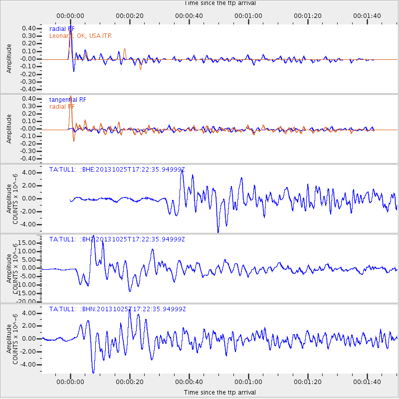
Signal To Noise
| Channel | StoN | STA | LTA |
| TA:TUL1: :BHZ:20131025T17:22:35.94999Z | 16.771421 | 4.043453E-6 | 2.410918E-7 |
| TA:TUL1: :BHN:20131025T17:22:35.94999Z | 3.57142 | 9.684256E-7 | 2.7115982E-7 |
| TA:TUL1: :BHE:20131025T17:22:35.94999Z | 4.6635537 | 9.204568E-7 | 1.973724E-7 |
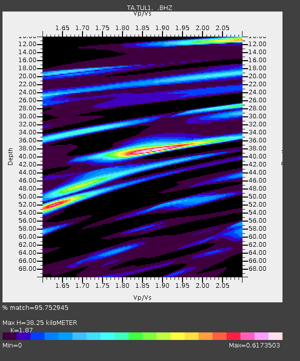
| Arrivals | |
| Ps | 5.2 SECOND |
| PpPs | 17 SECOND |
| PsPs/PpSs | 22 SECOND |

