
V49A McMinnville, TN, USA - Earthquake Result Viewer
| ||||||||||||||||||
| ||||||||||||||||||
| ||||||||||||||||||
|
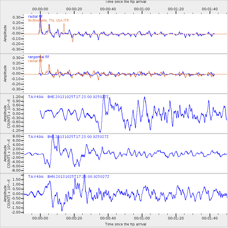
Signal To Noise
| Channel | StoN | STA | LTA |
| TA:V49A: :BHZ:20131025T17:23:00.925027Z | 10.147554 | 2.593124E-6 | 2.5554178E-7 |
| TA:V49A: :BHN:20131025T17:23:00.925027Z | 3.2251692 | 5.4517477E-7 | 1.6903759E-7 |
| TA:V49A: :BHE:20131025T17:23:00.925027Z | 2.0458796 | 4.787824E-7 | 2.3402276E-7 |
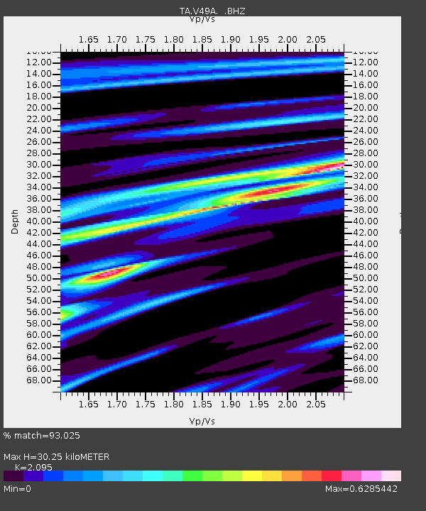
| Arrivals | |
| Ps | 5.3 SECOND |
| PpPs | 14 SECOND |
| PsPs/PpSs | 20 SECOND |

