V53A Saluda, NC, USA - Earthquake Result Viewer
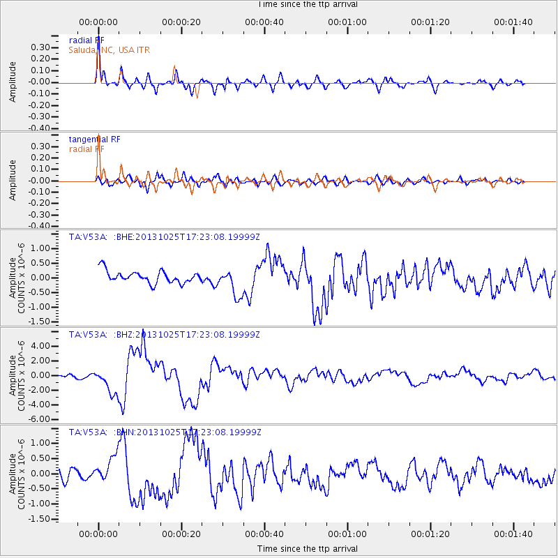
Earthquake location: Off East Coast Of Honshu, Japan
Earthquake latitude/longitude: 37.2/144.7
Earthquake time(UTC): 2013/10/25 (298) 17:10:19 GMT
Earthquake Depth: 35 km
Earthquake Magnitude: 7.1 MWW, 7.1 MWW, 7.1 MWB, 7.1 MWC, 7.2 MWC, 7.5 MI
Earthquake Catalog/Contributor: NEIC PDE/NEIC COMCAT
Network: TA USArray Transportable Network (new EarthScope stations)
Station: V53A Saluda, NC, USA
Lat/Lon: 35.67 N/82.81 W
Elevation: 681 m
Distance: 95.2 deg
Az: 37.053 deg
Baz: 323.756 deg
Ray Param: 0.040830422
Estimated Moho Depth: 37.75 km
Estimated Crust Vp/Vs: 1.92
Assumed Crust Vp: 6.35 km/s
Estimated Crust Vs: 3.312 km/s
Estimated Crust Poisson's Ratio: 0.31
Radial Match: 91.10926 %
Radial Bump: 400
Transverse Match: 71.60739 %
Transverse Bump: 400
SOD ConfigId: 626651
Insert Time: 2014-04-19 06:19:03.288 +0000
GWidth: 2.5
Max Bumps: 400
Tol: 0.001

Signal To Noise

ChannelStoNSTALTA
TA:V53A: :BHZ:20131025T17:23:08.19999Z11.2925341.7834321E-61.579302E-7
TA:V53A: :BHN:20131025T17:23:08.19999Z3.45928764.6205452E-71.3356927E-7
TA:V53A: :BHE:20131025T17:23:08.19999Z2.35167464.8592267E-72.0662837E-7
Arrivals
Ps5.6 SECOND
PpPs17 SECOND
PsPs/PpSs23 SECOND