V54A Nebo, NC, USA - Earthquake Result Viewer
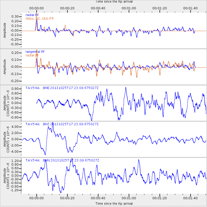
Earthquake location: Off East Coast Of Honshu, Japan
Earthquake latitude/longitude: 37.2/144.7
Earthquake time(UTC): 2013/10/25 (298) 17:10:19 GMT
Earthquake Depth: 35 km
Earthquake Magnitude: 7.1 MWW, 7.1 MWW, 7.1 MWB, 7.1 MWC, 7.2 MWC, 7.5 MI
Earthquake Catalog/Contributor: NEIC PDE/NEIC COMCAT
Network: TA USArray Transportable Network (new EarthScope stations)
Station: V54A Nebo, NC, USA
Lat/Lon: 35.78 N/81.95 W
Elevation: 448 m
Distance: 95.5 deg
Az: 36.417 deg
Baz: 324.318 deg
Ray Param: 0.04074384
Estimated Moho Depth: 21.5 km
Estimated Crust Vp/Vs: 1.86
Assumed Crust Vp: 6.419 km/s
Estimated Crust Vs: 3.447 km/s
Estimated Crust Poisson's Ratio: 0.30
Radial Match: 83.60253 %
Radial Bump: 400
Transverse Match: 65.976234 %
Transverse Bump: 400
SOD ConfigId: 626651
Insert Time: 2014-04-19 06:19:04.018 +0000
GWidth: 2.5
Max Bumps: 400
Tol: 0.001

Signal To Noise

ChannelStoNSTALTA
TA:V54A: :BHZ:20131025T17:23:09.675027Z6.6450461.9415504E-62.9218012E-7
TA:V54A: :BHN:20131025T17:23:09.675027Z2.09505874.3702622E-72.0859856E-7
TA:V54A: :BHE:20131025T17:23:09.675027Z2.21058233.256691E-71.4732278E-7
Arrivals
Ps2.9 SECOND
PpPs9.4 SECOND
PsPs/PpSs12 SECOND